MyTopo
Legion Texas US Topo Map
Couldn't load pickup availability
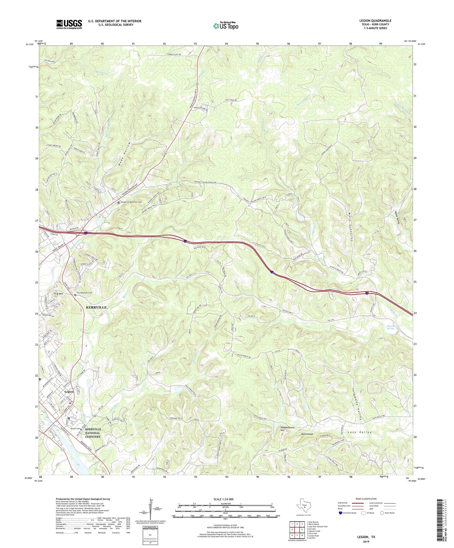
2022 topographic map quadrangle Legion in the state of Texas. Scale: 1:24000. Based on the newly updated USGS 7.5' US Topo map series, this map is in the following counties: Kerr. The map contains contour data, water features, and other items you are used to seeing on USGS maps, but also has updated roads and other features. This is the next generation of topographic maps. Printed on high-quality waterproof paper with UV fade-resistant inks.
Quads adjacent to this one:
West: Kerrville
Northwest: Nott Branch
North: Morris Ranch
Northeast: Lady Bird Johnson Park
East: Cypress Creek
Southeast: Comfort
South: Center Point
Southwest: Fall Creek
This map covers the same area as the classic USGS quad with code o30099a1.
Contains the following named places: Brown Cemetery, Camp Meeting Creek, Cypress Springs, Daniels Elementary School, Garden of Memories Cemetery, Haddenbrock Hill, Kerrville - Schreiner State Park Trail, Kerrville City Park, Kerrville Division, Kerrville Fire Department Station 3, Kerrville Lake, Kerrville National Cemetery, Kerrville Veterans Affairs Hospital, Legion, Lions Camp for Crippled Children, Peterson Junior High School, Rattlesnake Creek, Ravenhead, Second Creek, Telgmann Valley, Third Creek, Tivy Mountain, Tivy Mountain Cemetery, Vamc Heliport, Wade Hollow, Wein Schlucht