MyTopo
Concho Texas US Topo Map
Couldn't load pickup availability
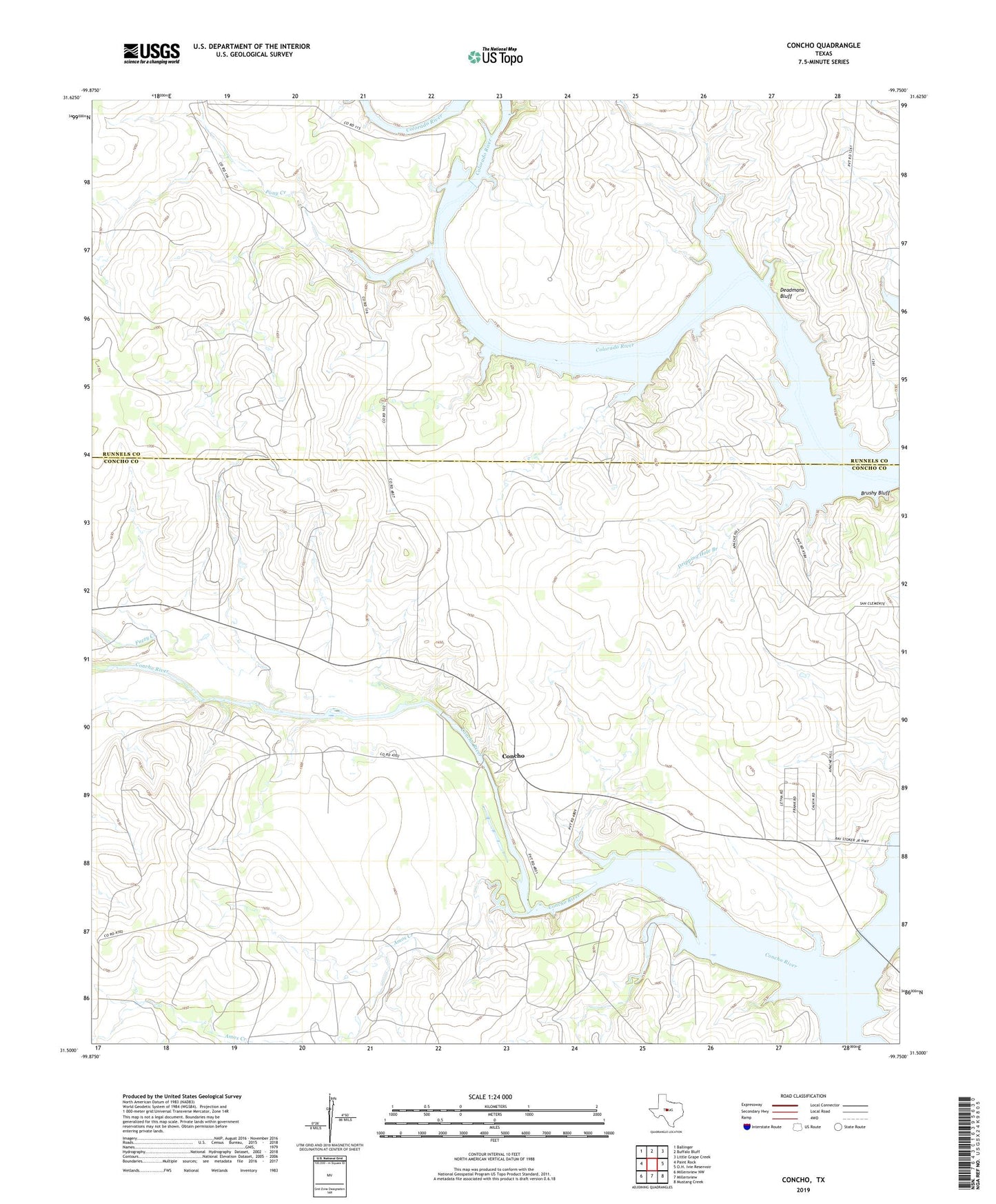
2022 topographic map quadrangle Concho in the state of Texas. Scale: 1:24000. Based on the newly updated USGS 7.5' US Topo map series, this map is in the following counties: Concho, Runnels. The map contains contour data, water features, and other items you are used to seeing on USGS maps, but also has updated roads and other features. This is the next generation of topographic maps. Printed on high-quality waterproof paper with UV fade-resistant inks.
Quads adjacent to this one:
West: Paint Rock
Northwest: Ballinger
North: Buffalo Bluff
Northeast: Little Grape Creek
Southeast: Mustang Creek
South: Millersview
Southwest: Millersview NW
This map covers the same area as the classic USGS quad with code o31099e7.
Contains the following named places: Amos Creek, Concho, Deadmans Bluff, Dripping Hole Branch, Duck Creek, Fuzzy Creek, Horse Creek, Pony Creek, Rocky Branch