MyTopo
Connor Texas US Topo Map
Couldn't load pickup availability
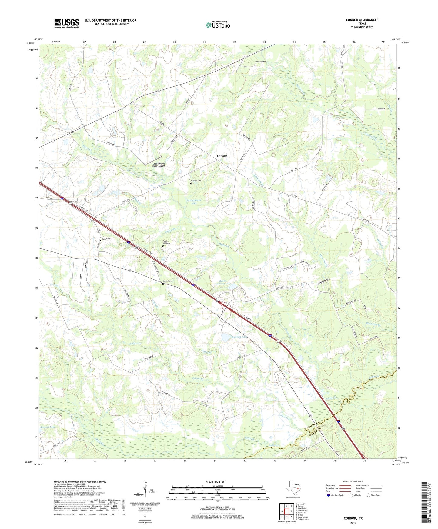
2019 topographic map quadrangle Connor in the state of Texas. Scale: 1:24000. Based on the newly updated USGS 7.5' US Topo map series, this map is in the following counties: Madison, Walker. The map contains contour data, water features, and other items you are used to seeing on USGS maps, but also has updated roads and other features. This is the next generation of topographic maps. Printed on high-quality waterproof paper with UV fade-resistant inks.
Quads adjacent to this one:
West: Madisonville
Northwest: Leona SW
North: Elwood
Northeast: Sand Ridge
East: Baker Lake
Southeast: Crabbs Prairie
South: Steep Branch
Southwest: Bedias
Contains the following named places: Burke-Sullivan Lake, Burke-Sullivan Lake Dam, Burrows Cemetery, Caney Creek, Collard Creek, Connor, Farris Cemetery, Jenkins, Joe Brown Lake, Larrison Cemetery, Lazy 8 Flying Ranch, Little Rock Church, Mill Branch, Nixon Branch, Park Cemetery, Pooles Creek, Rocky Hill Cemetery, Sand Branch, South Bethel School, Springboard Lake, Spurlock Lake, Spurlock Lake Dam, Willow Branch