MyTopo
Cotulla Texas US Topo Map
Couldn't load pickup availability
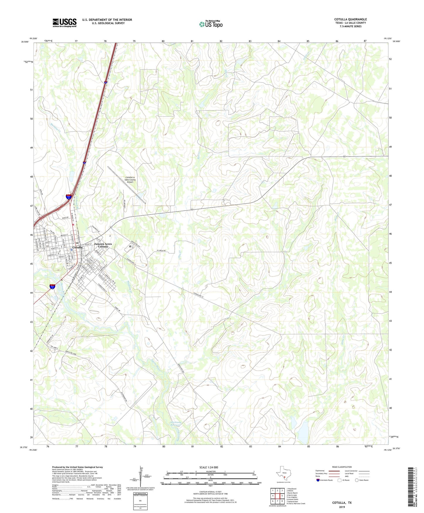
2022 topographic map quadrangle Cotulla in the state of Texas. Scale: 1:24000. Based on the newly updated USGS 7.5' US Topo map series, this map is in the following counties: La Salle. The map contains contour data, water features, and other items you are used to seeing on USGS maps, but also has updated roads and other features. This is the next generation of topographic maps. Printed on high-quality waterproof paper with UV fade-resistant inks.
Quads adjacent to this one:
West: Harris Lake
Northwest: Woodward
North: Millett
Northeast: Burns Ranch
East: Los Angeles
Southeast: Charco Marrano Creek
South: Holland Dam
Southwest: Artesia Wells
This map covers the same area as the classic USGS quad with code o28099d2.
Contains the following named places: Alexander Park, Allerkamp Reservoir, Allerkamp Reservoir Dam, Antigua Cemetery, Brush Country Museum, Burkett Dam, Burkett Lake, Burks Elementary School, City of Cotulla, Cohenour Reservoir, Cohenour Reservoir Dam, Cotulla, Cotulla Alternative School, Cotulla Cemetery, Cotulla Emergency Medical Service, Cotulla Post Office, Cotulla Volunteer Fire Department, Cotulla-La Salle County Airport, Elm Creek, First Baptist Church, Frank Newman Middle School, La Salle County Constable's Office, La Salle County Constable's Office Precinct 1, La Salle County Jail, La Salle County Sheriff's Office, Macomber Reservoir, Macomber Reservoir Dam, Mustang Creek, Ramirez Elementary School, Texas Department of Criminal Justice Cotulla Transfer Facility, United States Border Patrol Station, Zamora Acres Colonia