MyTopo
Cross Cut Texas US Topo Map
Couldn't load pickup availability
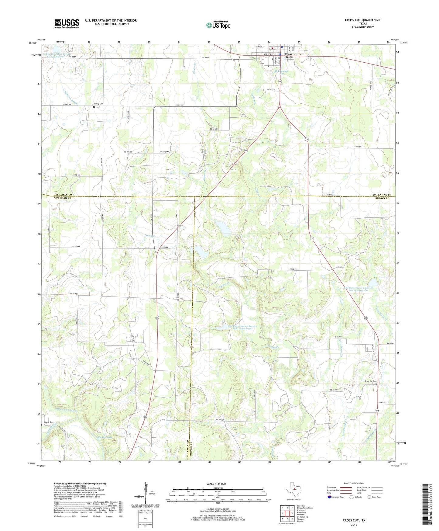
2022 topographic map quadrangle Cross Cut in the state of Texas. Scale: 1:24000. Based on the newly updated USGS 7.5' US Topo map series, this map is in the following counties: Brown, Callahan, Coleman. The map contains contour data, water features, and other items you are used to seeing on USGS maps, but also has updated roads and other features. This is the next generation of topographic maps. Printed on high-quality waterproof paper with UV fade-resistant inks.
Quads adjacent to this one:
West: Webbville
Northwest: Rowden
North: Cross Plains North
Northeast: Sabanno
East: Pioneer
Southeast: Byrds
South: Burkett
Southwest: Coleman NE
This map covers the same area as the classic USGS quad with code o32099a2.
Contains the following named places: Burkett Lake, Burkett Oil Field, Callahan County Deputy Constable's Office, Callahan County Deputy Sheriff's Office, Cross Cut, Cross Cut Cemetery, Cross Plains City Hall, Cross Plains Memorial Park, Cross Plains Oil Field, Cross Plains Police Department, Cross Plains Volunteer Fire Department, Dinner Branch, Dooley Creek, Dressy Cemetery, Little Pecan Bayou, McDonough Lake, McDonough Lake Dam, Robert E Howard House, Soil Conservation Service Site 10 Dam, Soil Conservation Service Site 10 Reservoir, Soil Conservation Service Site 11a Dam, Soil Conservation Service Site 11a Reservoir, Soil Conservation Service Site 12 Dam, Soil Conservation Service Site 12 Reservoir, Soil Conservation Service Site 22 Dam, Soil Conservation Service Site 22 Reservoir, Soil Conservation Service Site 26 Dam, Soil Conservation Service Site 26 Reservoir, Texas Department of Public Safety Highway Patrol Office