MyTopo
Coleman NE Texas US Topo Map
Couldn't load pickup availability
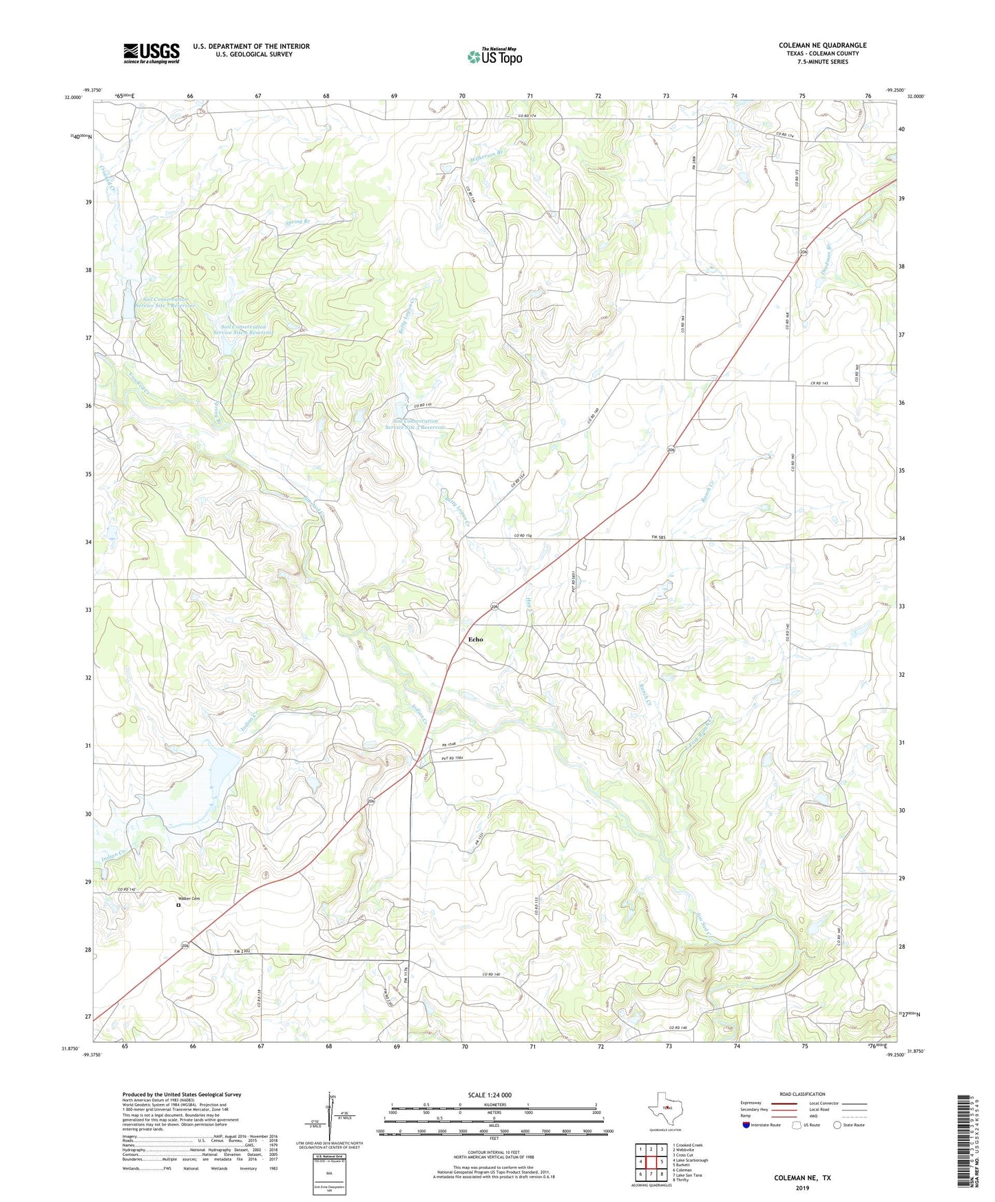
2022 topographic map quadrangle Coleman NE in the state of Texas. Scale: 1:24000. Based on the newly updated USGS 7.5' US Topo map series, this map is in the following counties: Coleman. The map contains contour data, water features, and other items you are used to seeing on USGS maps, but also has updated roads and other features. This is the next generation of topographic maps. Printed on high-quality waterproof paper with UV fade-resistant inks.
Quads adjacent to this one:
West: Lake Scarborough
Northwest: Crooked Creek
North: Webbville
Northeast: Cross Cut
East: Burkett
Southeast: Thrifty
South: Lake San Tana
Southwest: Coleman
This map covers the same area as the classic USGS quad with code o31099h3.
Contains the following named places: Betty Logan Creek, Camp Colorado, Coleman Division, Cow Creek, Crooked Creek, East Fork Ranch Creek, Eastland Morris Oil Field, Echo, Echo Oil Field, Hay Creek, Indian Creek, Ranch Creek, Soil Conservation Service Site 25 Dam, Soil Conservation Service Site 25 Reservoir, Soil Conservation Service Site 5 Dam, Soil Conservation Service Site 5 Reservoir, Soil Conservation Service Site 6 Dam, Soil Conservation Service Site 6 Reservoir, Soil Conservation Service Site 7 Dam, Soil Conservation Service Site 7 Reservoir, Spring Branch, Walker Cemetery