MyTopo
Crowther Texas US Topo Map
Couldn't load pickup availability
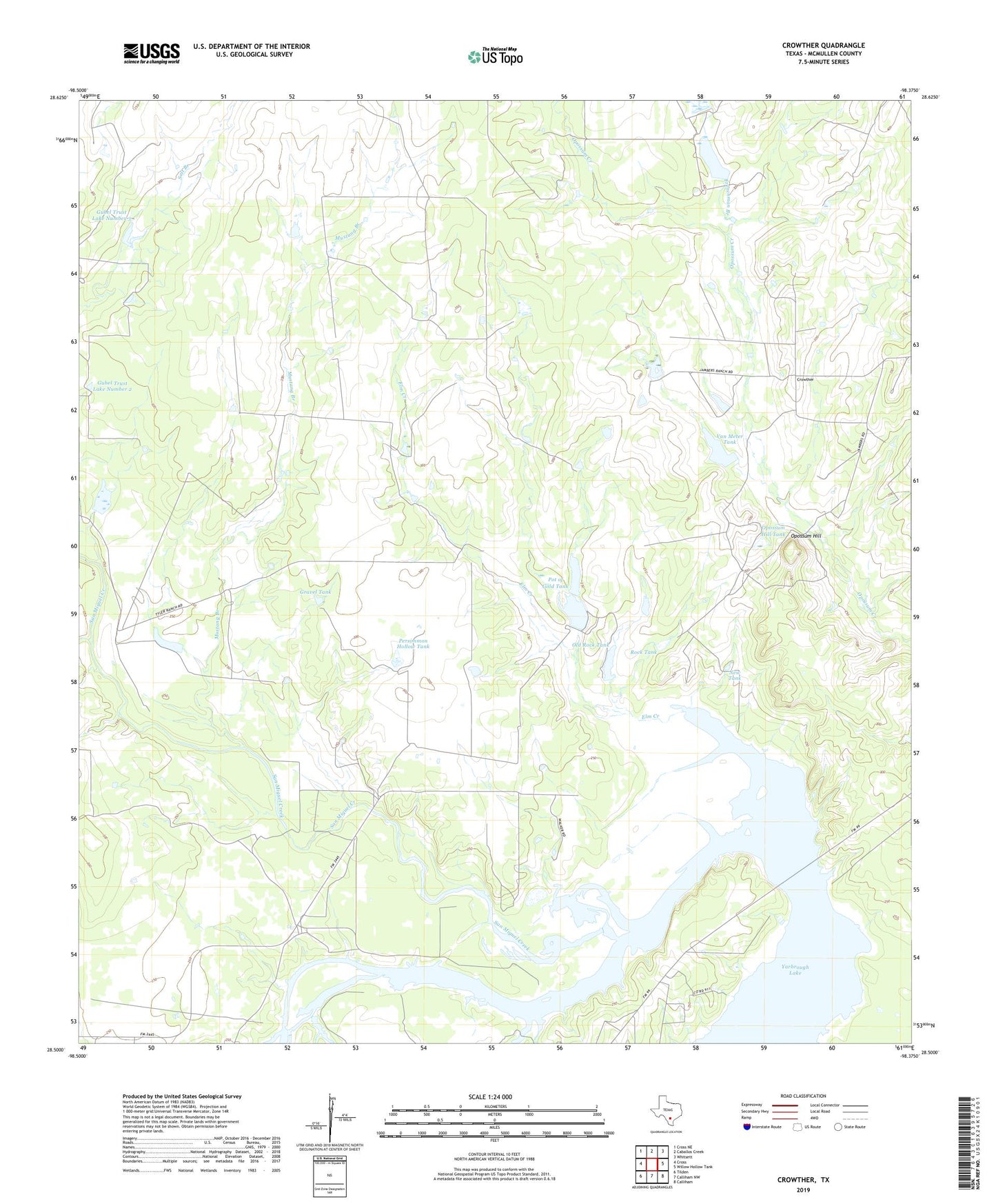
2022 topographic map quadrangle Crowther in the state of Texas. Scale: 1:24000. Based on the newly updated USGS 7.5' US Topo map series, this map is in the following counties: McMullen. The map contains contour data, water features, and other items you are used to seeing on USGS maps, but also has updated roads and other features. This is the next generation of topographic maps. Printed on high-quality waterproof paper with UV fade-resistant inks.
Quads adjacent to this one:
West: Cross
Northwest: Cross NE
North: Caballos Creek
Northeast: Whitsett
East: Willow Hollow Tank
Southeast: Calliham
South: Calliham NW
Southwest: Tilden
This map covers the same area as the classic USGS quad with code o28098e4.
Contains the following named places: Brown Tank, Brown Tank Dam, Crowther, Elm Creek, Frenchman Branch, Gravel Tank, Gubel Trust Lake Number 2, Gubel Trust Lake Number 2 Dam, Gubel Trust Lake Number 3, Gubel Trust Lake Number 3 Dam, Horseshoe Tank, Horton Lake, Horton Lake Dam, Mustang Branch, New Tank, Old Rock Tank, Old Rock Tank Dam, Opossum Hill, Opossum Hill Tank, Persimmon Hollow Tank, Pot of Gold Tank, Pot of Gold Tank Dam, Rock Tank, Salt Branch, San Miguel Creek, Van Meter Tank, Van Meter Tank Dam, Yarbrough Lake