MyTopo
Daisetta Texas US Topo Map
Couldn't load pickup availability
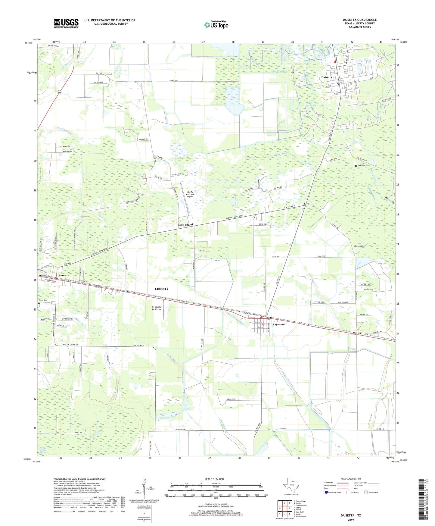
2019 topographic map quadrangle Daisetta in the state of Texas. Scale: 1:24000. Based on the newly updated USGS 7.5' US Topo map series, this map is in the following counties: Liberty. The map contains contour data, water features, and other items you are used to seeing on USGS maps, but also has updated roads and other features. This is the next generation of topographic maps. Printed on high-quality waterproof paper with UV fade-resistant inks.
Quads adjacent to this one:
West: Liberty
Northwest: Capers Ridge
North: Hardin
Northeast: Thorson Gully
East: Devers
Southeast: Whites Bayou
South: Shiloh
Southwest: Moss Bluff
Contains the following named places: Ames, Ames City Hall, Ames Community Volunteer Fire Department, Berean Tabernacle Baptist Church, City of Ames, City of Daisetta, Cow Island, Daisetta, Daisetta City Municipal Building, Daisetta Police Department, Daisetta Post Office, Daisetta Swamp, Darrell Airport, Davell Airport, Frige Settlement, George W Maxwell Levee, George W Maxwell Reservoir, Gillard-Duncan House, Hull - Daisetta Volunteer Fire Department, Liberty County Constable's Office Precinct 2, Liberty County Emergency Medical Services, Liberty Municipal Airport, Long Island Creek, Magnolia Ridge Country Club, Moore Settlement, Norman House, Oak Dale Cemetery, Our Mother of Mercy Catholic Cemetery, Raywood, Raywood Post Office, Raywood Volunteer Fire Department, Rock Island, Sacred Heart Church, Sam Houston Regional Library, Tri-County Air Service, Woodson, ZIP Code: 77575