MyTopo
Hardin Texas US Topo Map
Couldn't load pickup availability
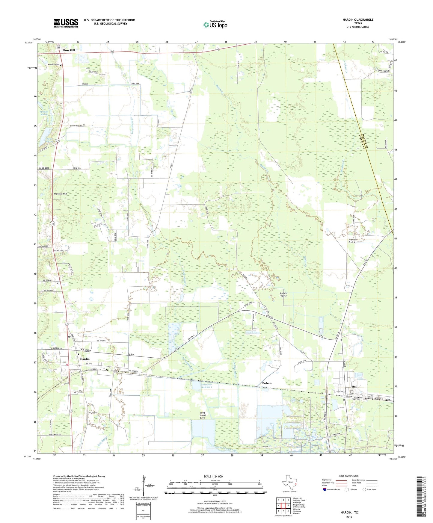
2022 topographic map quadrangle Hardin in the state of Texas. Scale: 1:24000. Based on the newly updated USGS 7.5' US Topo map series, this map is in the following counties: Liberty, Hardin. The map contains contour data, water features, and other items you are used to seeing on USGS maps, but also has updated roads and other features. This is the next generation of topographic maps. Printed on high-quality waterproof paper with UV fade-resistant inks.
Quads adjacent to this one:
West: Capers Ridge
Northwest: Davis Hill
North: Arizona Creek
Northeast: Saratoga
East: Thorson Gully
Southeast: Devers
South: Daisetta
Southwest: Liberty
This map covers the same area as the classic USGS quad with code o30094b6.
Contains the following named places: Batiste Prairie, Batiste Woods, City of Hardin, Dowdel Settlement, Hardin, Hardin City Hall, Hardin Elementary School, Hardin Post Office, Hardin School, Hardin Volunteer Fire Department, Hawkins Hill, Hull, Hull Census Designated Place, Hull Oil and Gas Field, Hull Post Office, Lake Forest, Lake Forest Dam, Liberty County Constable's Office Precinct 3, Liberty County Fire Marshal's Office, Long Island Cove, Long Island Woods, Lovell Reservoir Number 1 Levee, Mayhaw Prairie, Moss Hill, Moss Hill Cemetery, Mount Calvary Church, New Hope, North Hill Church, Pedeco, Reservoir Number 1, Tanner Settlement, Walker Marsh, ZIP Codes: 77561, 77564