
MyTopo
Dayton Texas US Topo Map
Couldn't load pickup availability
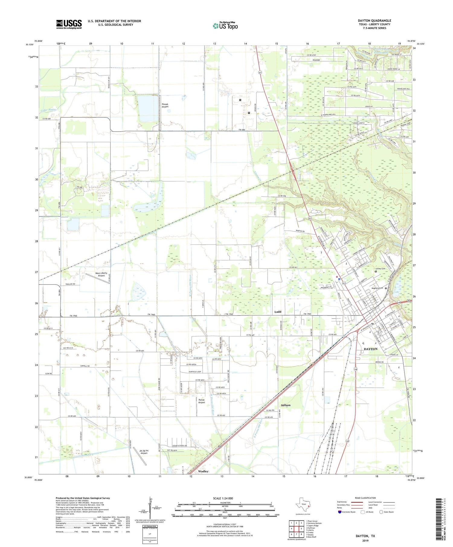
2019 topographic map quadrangle Dayton in the state of Texas. Scale: 1:24000. Based on the newly updated USGS 7.5' US Topo map series, this map is in the following counties: Liberty. The map contains contour data, water features, and other items you are used to seeing on USGS maps, but also has updated roads and other features. This is the next generation of topographic maps. Printed on high-quality waterproof paper with UV fade-resistant inks.
Quads adjacent to this one:
West: Huffman
Northwest: Plum Grove
North: Simmons Bottom
Northeast: Capers Ridge
East: Liberty
Southeast: Moss Bluff
South: Sheeks
Southwest: Crosby
Contains the following named places: Austin Elementary School, Calvary Church, City of Dayton, Colbert Elementary School, Colbert High School, Dayton, Dayton City Hall, Dayton City Park, Dayton Fire Department, Dayton Police Department, Dayton Post Office, Dayton Stadium, First United Methodist Church of Dayton, Fullerton, Gum Grove, Jamison Airstrip, Jet Ag Inc Airport, Ladd, Liberty County Constable's Office Precinct 4, Liberty County Emergency Medical Service, Liberty County Sheriff's Office, Linney Cemetery, Magnolia Park Cemetery, Martha, Martha Oil Field, Mount Olive Church, North Dayton Oil Field, Palms Memorial Park, Pavlat Airport, Pinoak Airport, Richter Elementary School, Seaberg Ranch Airport, Smesny Farms Airport, Stilson, Texas Department of Criminal Justice Dempsie Henley State Jail, Texas Department of Criminal Justice Lucile Plane State Jail, Wadley, West Liberty Airport, Wilson Junior High School, Winter Valley Estates Dam, Winter Valley Estates Lake, ZIP Code: 77535


