MyTopo
Deep Creek Texas US Topo Map
Couldn't load pickup availability
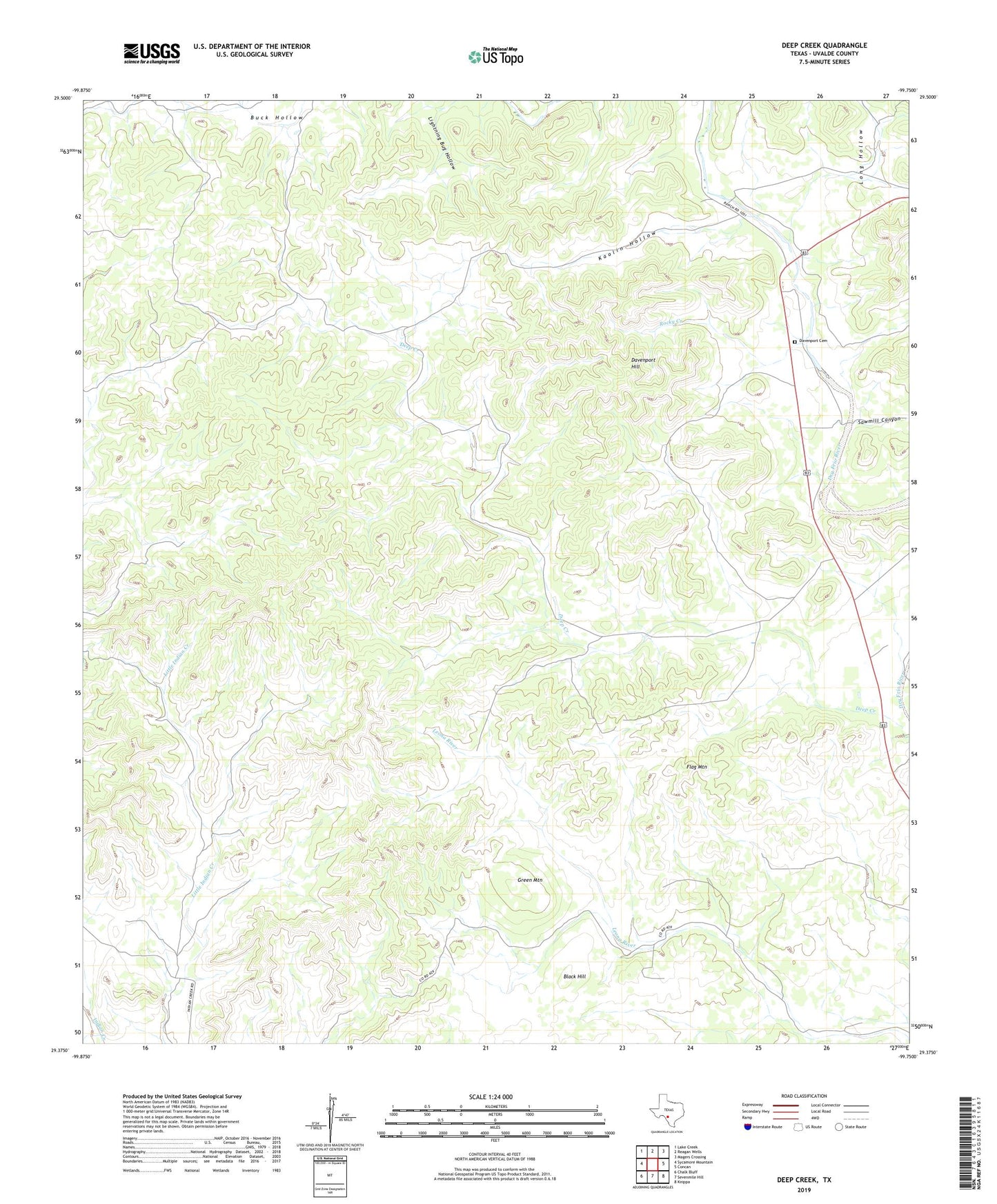
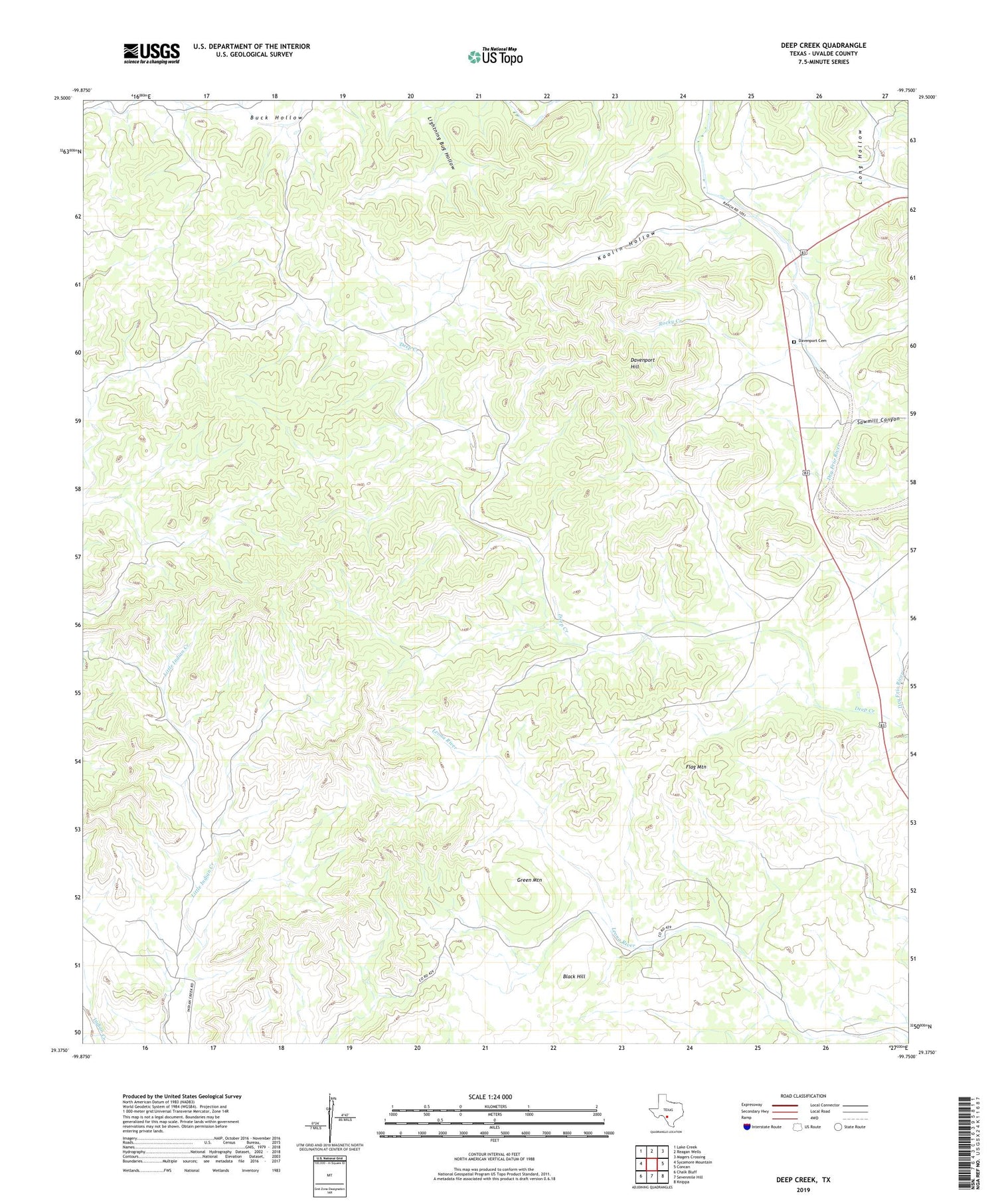
2019 topographic map quadrangle Deep Creek in the state of Texas. Scale: 1:24000. Based on the newly updated USGS 7.5' US Topo map series, this map is in the following counties: Uvalde. The map contains contour data, water features, and other items you are used to seeing on USGS maps, but also has updated roads and other features. This is the next generation of topographic maps. Printed on high-quality waterproof paper with UV fade-resistant inks.
Quads adjacent to this one:
West: Sycamore Mountain
Northwest: Lake Creek
North: Reagan Wells
Northeast: Magers Crossing
East: Concan
Southeast: Knippa
South: Sevenmile Hill
Southwest: Chalk Bluff
Contains the following named places: Black Hill, Davenport Cemetery, Davenport Hill, Flag Mountain, Green Mountain, Kaolin Hollow, Long Hollow, Rocky Creek, Sawmill Canyon