MyTopo
Concan Texas US Topo Map
Couldn't load pickup availability
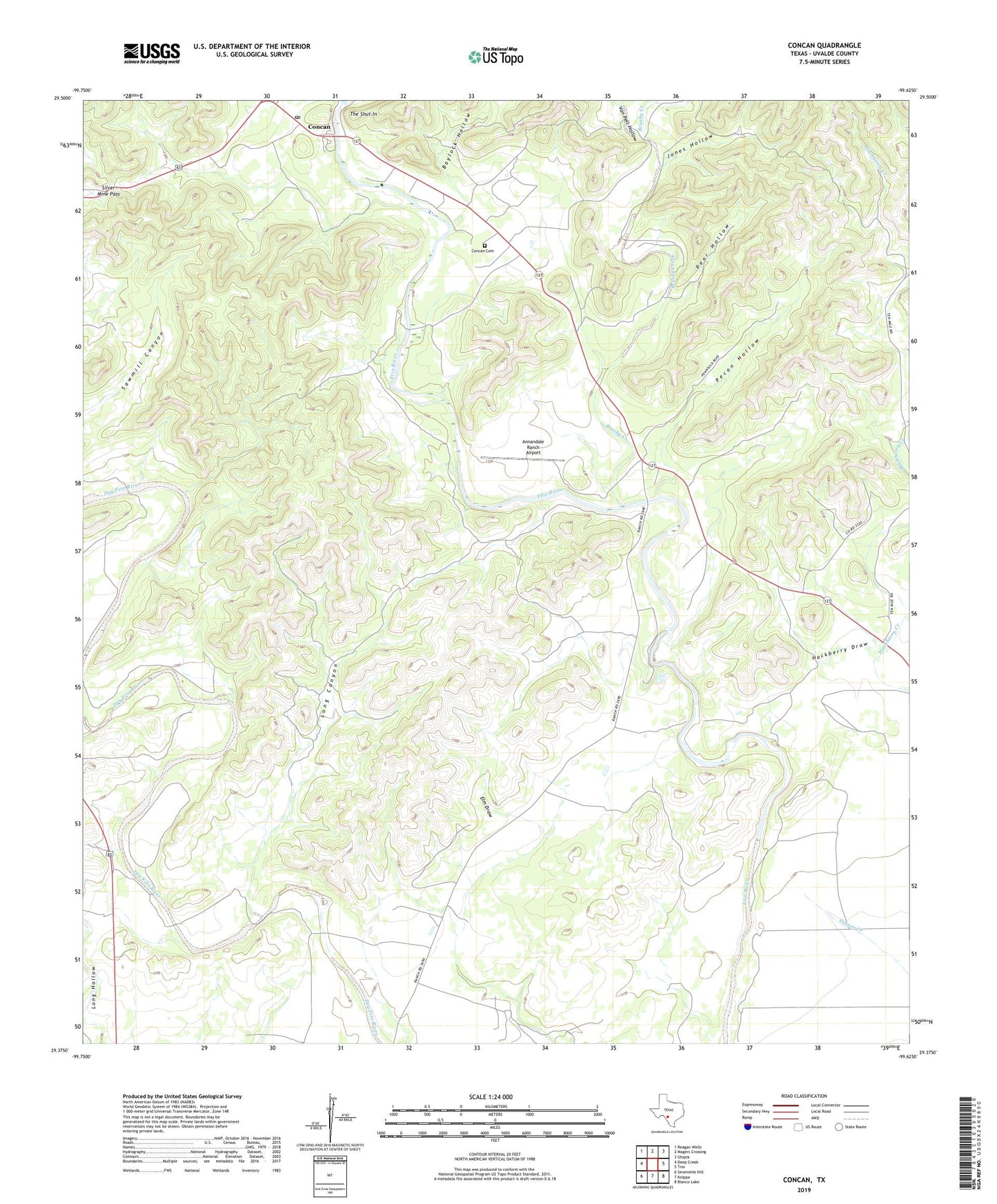
2022 topographic map quadrangle Concan in the state of Texas. Scale: 1:24000. Based on the newly updated USGS 7.5' US Topo map series, this map is in the following counties: Uvalde. The map contains contour data, water features, and other items you are used to seeing on USGS maps, but also has updated roads and other features. This is the next generation of topographic maps. Printed on high-quality waterproof paper with UV fade-resistant inks.
Quads adjacent to this one:
West: Deep Creek
Northwest: Reagan Wells
North: Magers Crossing
Northeast: Utopia
East: Trio
Southeast: Blanco Lake
South: Knippa
Southwest: Sevenmile Hill
This map covers the same area as the classic USGS quad with code o29099d6.
Contains the following named places: Annandale Ranch Airport, Baylock Hollow, Big Tree Ranch, Brushy Creek, Concan, Concan Cemetery, Concan Post Office, Deep Creek, First Crossing, Fitzgerald Ranch, Hackberry Draw, Howard Ranch, Jones Hollow, Long Canyon, Meyer Ranch, Pear Hollow, Pecan Hollow, Shut-in Hollow, Silver Mine Pass, Stoner Ranch, The Big Tree, The Shut-In, Van Pelt Hollow, Van Pelt Ranch