MyTopo
Democrat Texas US Topo Map
Couldn't load pickup availability
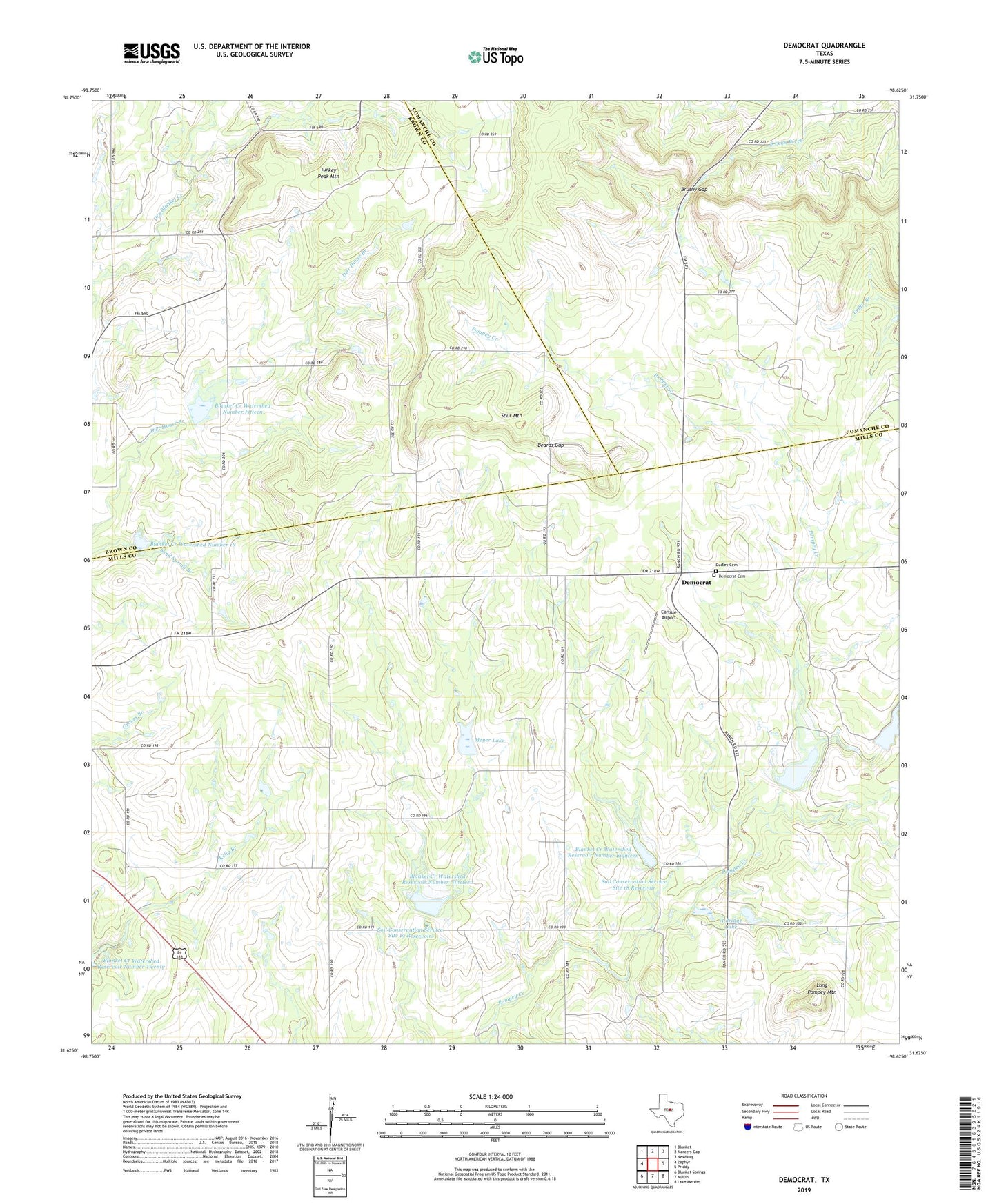
2019 topographic map quadrangle Democrat in the state of Texas. Scale: 1:24000. Based on the newly updated USGS 7.5' US Topo map series, this map is in the following counties: Mills, Brown, Comanche. The map contains contour data, water features, and other items you are used to seeing on USGS maps, but also has updated roads and other features. This is the next generation of topographic maps. Printed on high-quality waterproof paper with UV fade-resistant inks.
Quads adjacent to this one:
West: Zephyr
Northwest: Blanket
North: Mercers Gap
Northeast: Newburg
East: Priddy
Southeast: Lake Merritt
South: Mullin
Southwest: Blanket Springs
Contains the following named places: Aldridge Lake, Aldridge Lake Dam, Beards Gap, Bethel Church, Blanket Creek Watershed Number 16, Blanket Creek Watershed Number Fifteen, Blanket Creek Watershed Reservoir Number Eighteen, Blanket Creek Watershed Reservoir Number Nineteen, Brushy Gap, Carlisle Airport, Democrat, Democrat Cemetery, Dudley Cemetery, Lethco Lake, Lethco Lake Dam, Long Pompey Mountain, Meyer Lake, Meyer Lake Dam, Soil Conservation Service Site 15 Dam, Soil Conservation Service Site 16 Dam, Soil Conservation Service Site 16 Reservoir, Soil Conservation Service Site 17a-1 Dam, Soil Conservation Service Site 17a-1 Reservoir, Soil Conservation Service Site 18 Dam, Soil Conservation Service Site 18 Reservoir, Soil Conservation Service Site 19 Dam, Soil Conservation Service Site 19 Reservoir, Spur Mountain, Turkey Peak Mountain