MyTopo
Ding Dong Texas US Topo Map
Couldn't load pickup availability
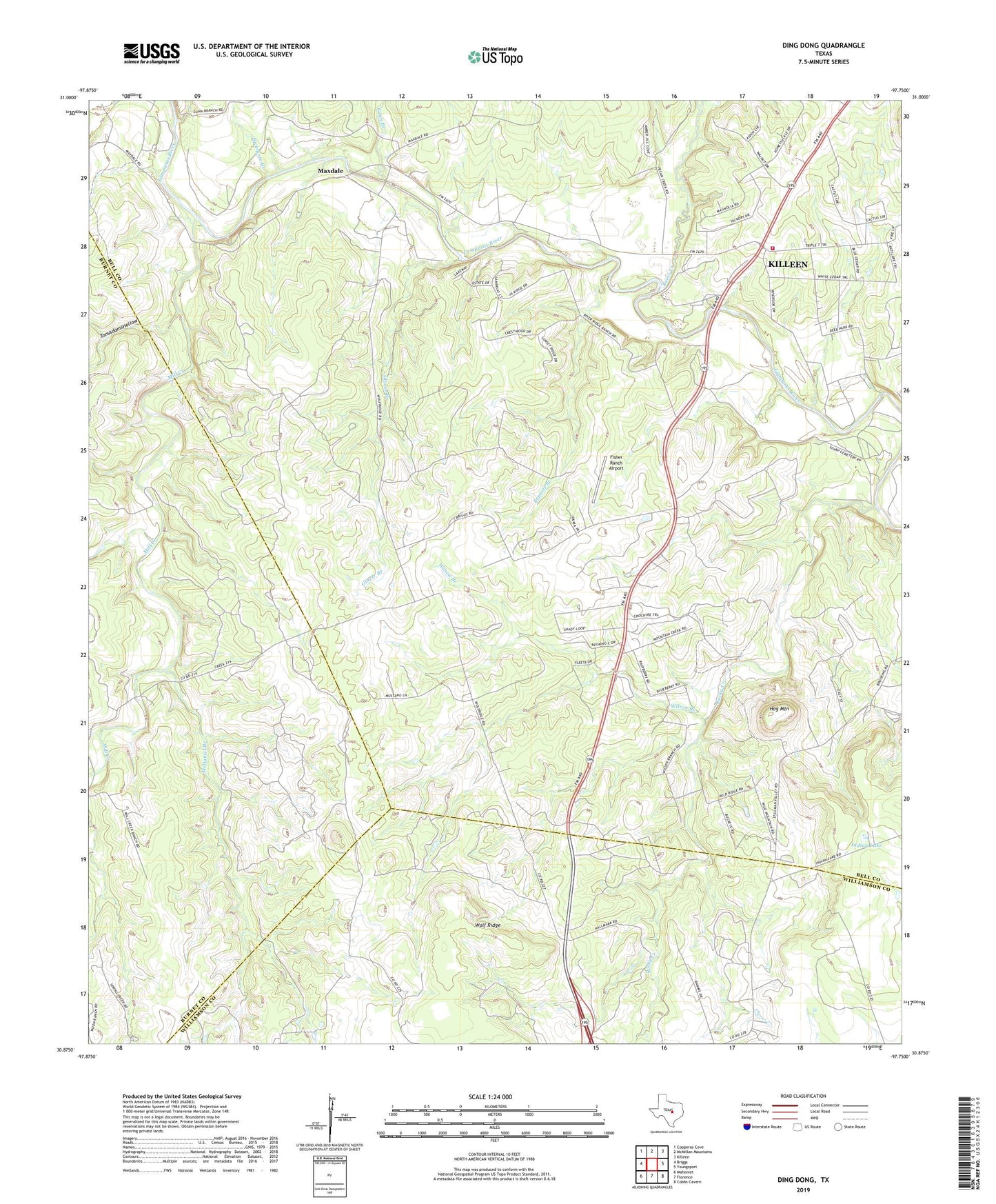
2022 topographic map quadrangle Ding Dong in the state of Texas. Scale: 1:24000. Based on the newly updated USGS 7.5' US Topo map series, this map is in the following counties: Bell, Burnet, Williamson. The map contains contour data, water features, and other items you are used to seeing on USGS maps, but also has updated roads and other features. This is the next generation of topographic maps. Printed on high-quality waterproof paper with UV fade-resistant inks.
Quads adjacent to this one:
West: Briggs
Northwest: Copperas Cove
North: McMillan Mountains
Northeast: Killeen
East: Youngsport
Southeast: Cobbs Cavern
South: Florence
Southwest: Mahomet
This map covers the same area as the classic USGS quad with code o30097h7.
Contains the following named places: Bennett Branch, Ding Dong, Fisher Ranch Airport, Gann Branch, Glover Branch, Hog Mountain, Indian Lake, Maxdale, Maxdale Community Center, McDaniel Branch, Mill Creek, Reese Creek, Rock Creek Church, Rocky Creek, Southwest Bell County Fire Station, Southwest Bell Division, Sycamore Branch, Tom Adams Hollow, White Airport, Wilson Branch, Wolf Ridge