MyTopo
Divide Well Draw Texas US Topo Map
Couldn't load pickup availability
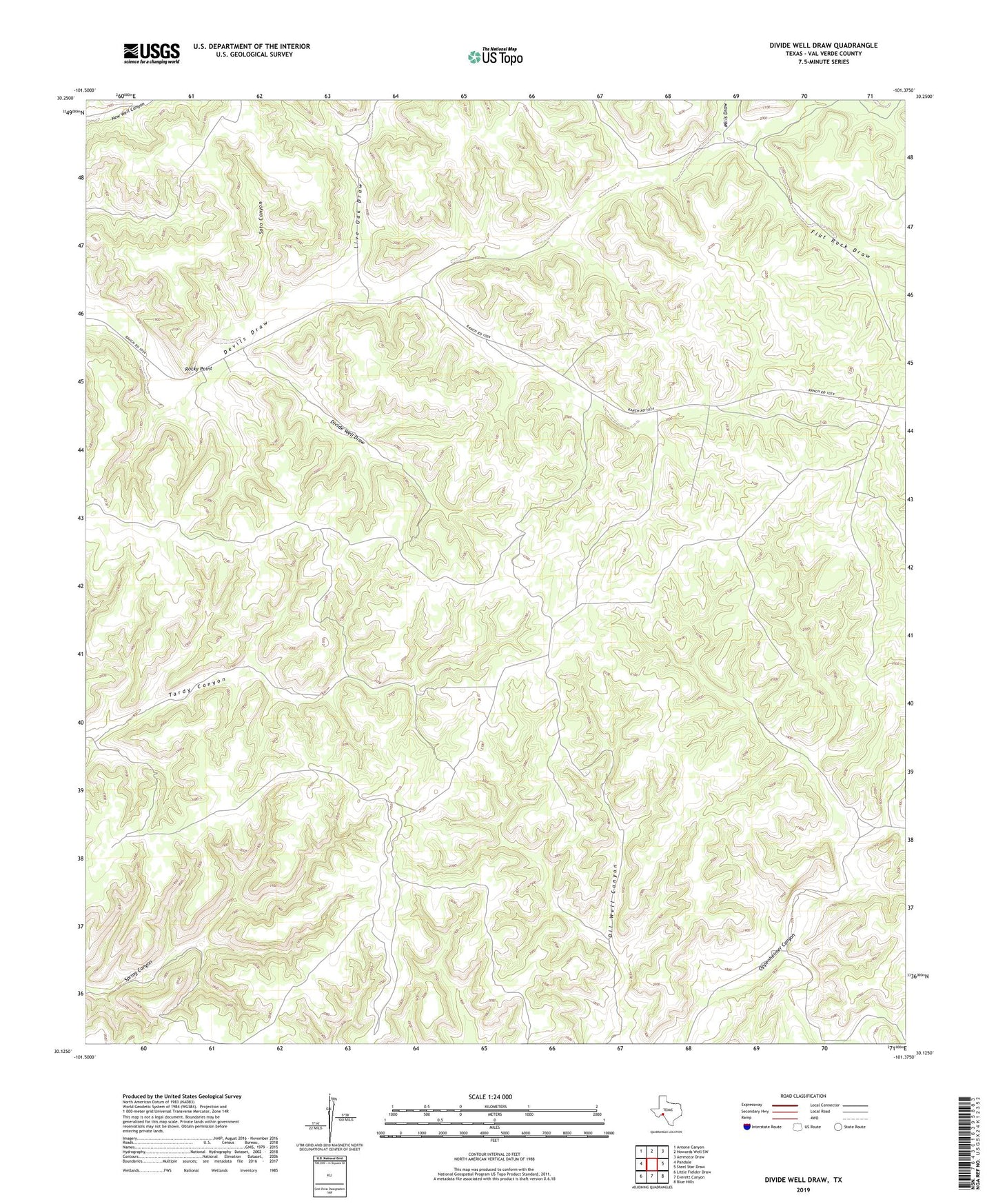
2022 topographic map quadrangle Divide Well Draw in the state of Texas. Scale: 1:24000. Based on the newly updated USGS 7.5' US Topo map series, this map is in the following counties: Val Verde. The map contains contour data, water features, and other items you are used to seeing on USGS maps, but also has updated roads and other features. This is the next generation of topographic maps. Printed on high-quality waterproof paper with UV fade-resistant inks.
Quads adjacent to this one:
West: Pandale
Northwest: Antone Canyon
North: Howards Well SW
Northeast: Aermotor Draw
East: Steel Star Draw
Southeast: Blue Hills
South: Everett Canyon
Southwest: Little Fielder Draw
This map covers the same area as the classic USGS quad with code o30101b4.
Contains the following named places: Arledge Ranch, Brown Windmill, Divide Well Draw, Divide Windmill, East Windmill, Flat Rock Draw, Flat Rock Windmill, Javelina Windmill, Live Oak Draw, Mayfield Ranch, Mills Draw, Mills Ranch, Mills Ranch Airport, Red Windmill, Rocky Point, Soto Canyon, Sulfur Windmill, Warsaw Windmill