MyTopo
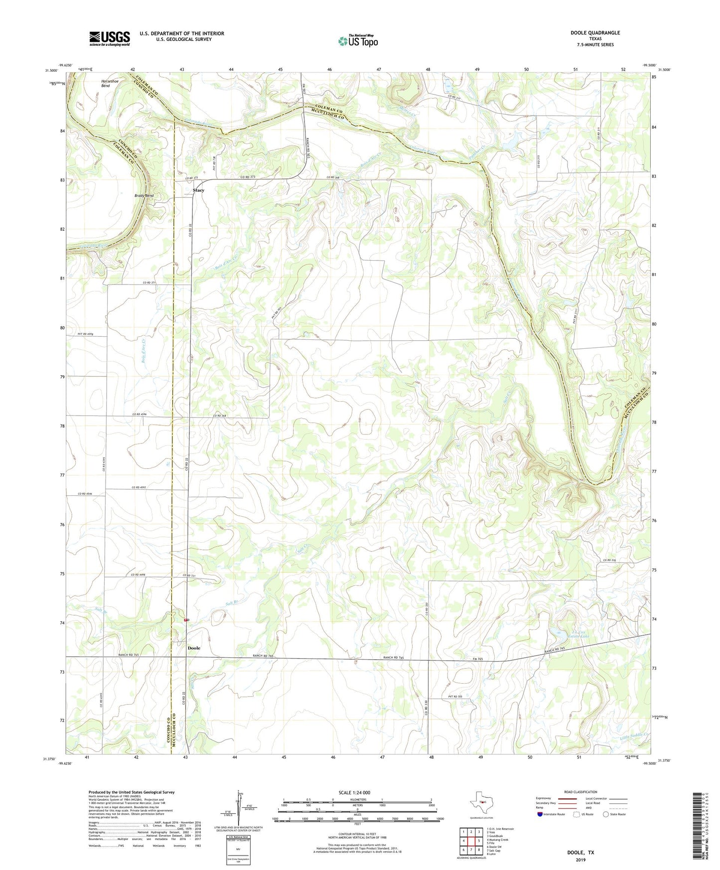
Doole Texas US Topo Map
Couldn't load pickup availability
2022 topographic map quadrangle Doole in the state of Texas. Scale: 1:24000. Based on the newly updated USGS 7.5' US Topo map series, this map is in the following counties: McCulloch, Coleman, Concho. The map contains contour data, water features, and other items you are used to seeing on USGS maps, but also has updated roads and other features. This is the next generation of topographic maps. Printed on high-quality waterproof paper with UV fade-resistant inks.
Quads adjacent to this one:
West: Mustang Creek
North: Voss
Northeast: Gouldbusk
East: Fife
Southeast: Lohn
South: Salt Gap
Southwest: Doole SW
This map covers the same area as the classic USGS quad with code o31099d5.
Contains the following named places: Bois d'Arc Creek, Brady Bend, Doole, Doole Post Office, Doole Volunteer Fire Department, J L Cox Estate Lake, J L Cox Estate Lake Dam, Mercer Creek, Panther Creek, Salt Branch, Salt Creek, Stacy, ZIP Code: 76836