MyTopo
Fife Texas US Topo Map
Couldn't load pickup availability
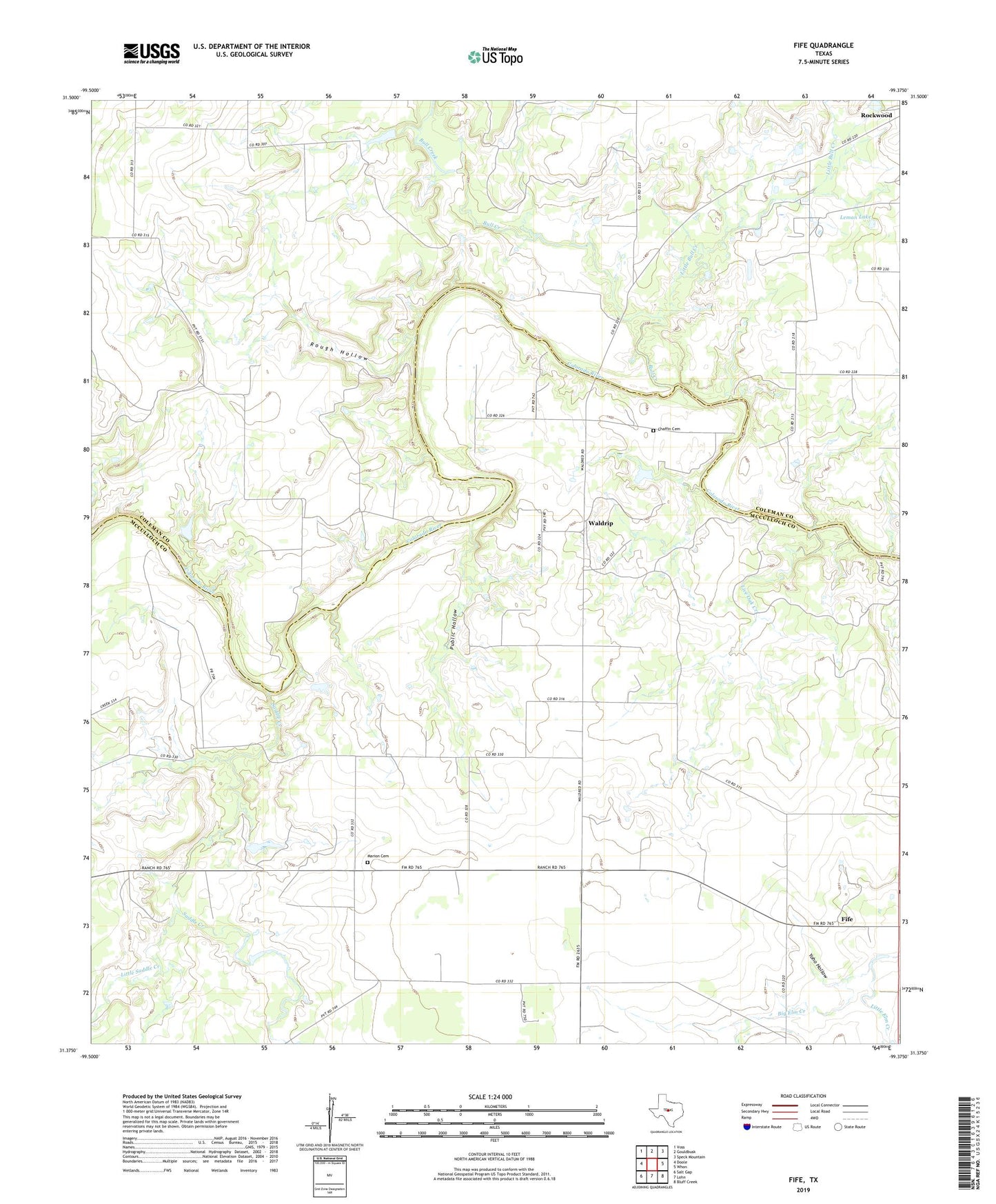
2022 topographic map quadrangle Fife in the state of Texas. Scale: 1:24000. Based on the newly updated USGS 7.5' US Topo map series, this map is in the following counties: McCulloch, Coleman. The map contains contour data, water features, and other items you are used to seeing on USGS maps, but also has updated roads and other features. This is the next generation of topographic maps. Printed on high-quality waterproof paper with UV fade-resistant inks.
Quads adjacent to this one:
West: Doole
Northwest: Voss
North: Gouldbusk
Northeast: Speck Mountain
East: Whon
Southeast: Bluff Creek
South: Lohn
Southwest: Salt Gap
This map covers the same area as the classic USGS quad with code o31099d4.
Contains the following named places: Big Elm Creek, Bull Creek, Chaffin Cemetery, Chaffin Crossing, Fife, Hays Crossing, Leman Lake, Little Bull Creek, Little Elm Creek, Little Saddle Creek, Live Oak Creek, Marion Cemetery, Public Hollow, Rough Hollow, Saddle Creek, Waldrip, Walker Ranch Airport, Yoho Hollow