MyTopo
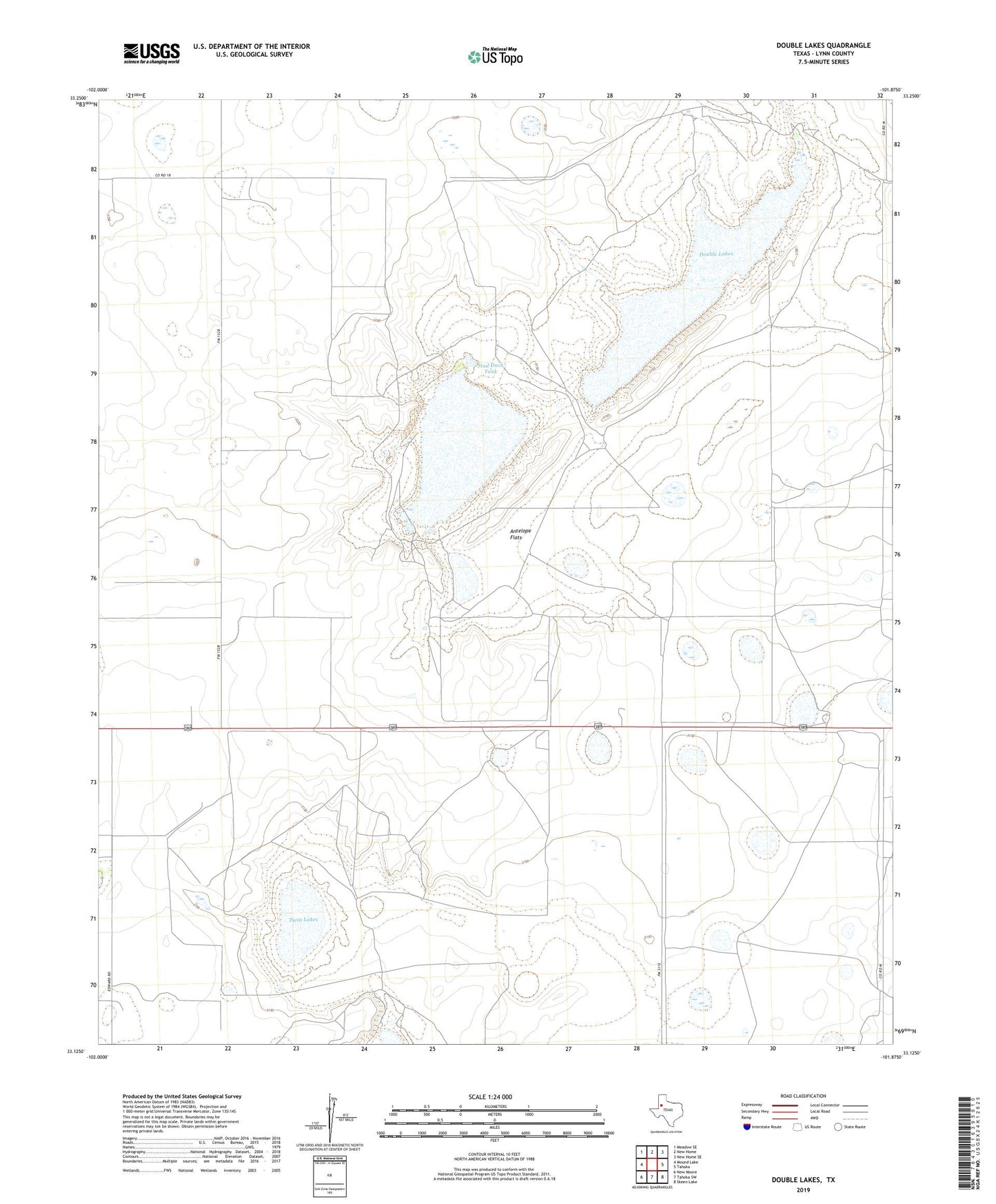
Double Lakes Texas US Topo Map
Couldn't load pickup availability
2022 topographic map quadrangle Double Lakes in the state of Texas. Scale: 1:24000. Based on the newly updated USGS 7.5' US Topo map series, this map is in the following counties: Lynn. The map contains contour data, water features, and other items you are used to seeing on USGS maps, but also has updated roads and other features. This is the next generation of topographic maps. Printed on high-quality waterproof paper with UV fade-resistant inks.
Quads adjacent to this one:
West: Mound Lake
Northwest: Meadow SE
North: New Home
Northeast: New Home SE
East: Tahoka
Southeast: Skeen Lake
South: Tahoka SW
Southwest: New Moore
This map covers the same area as the classic USGS quad with code o33101b8.
Contains the following named places: Antelope Flats, Antelope Windmill, Big Four Well, Crow Windmill, Crows Nest Windmill, Double Lakes, Eureka Windmill, High Lonesome Windmill, Horse Pasture Windmill, KLSC-FM (Lamesa), Line Windmill, Little Gyp Windmill, Little Windmill, Middle Windmill, Stud Duck Tank, T Bar Ranch, Twin Lakes