MyTopo
Atlanta North Texas US Topo Map
Couldn't load pickup availability
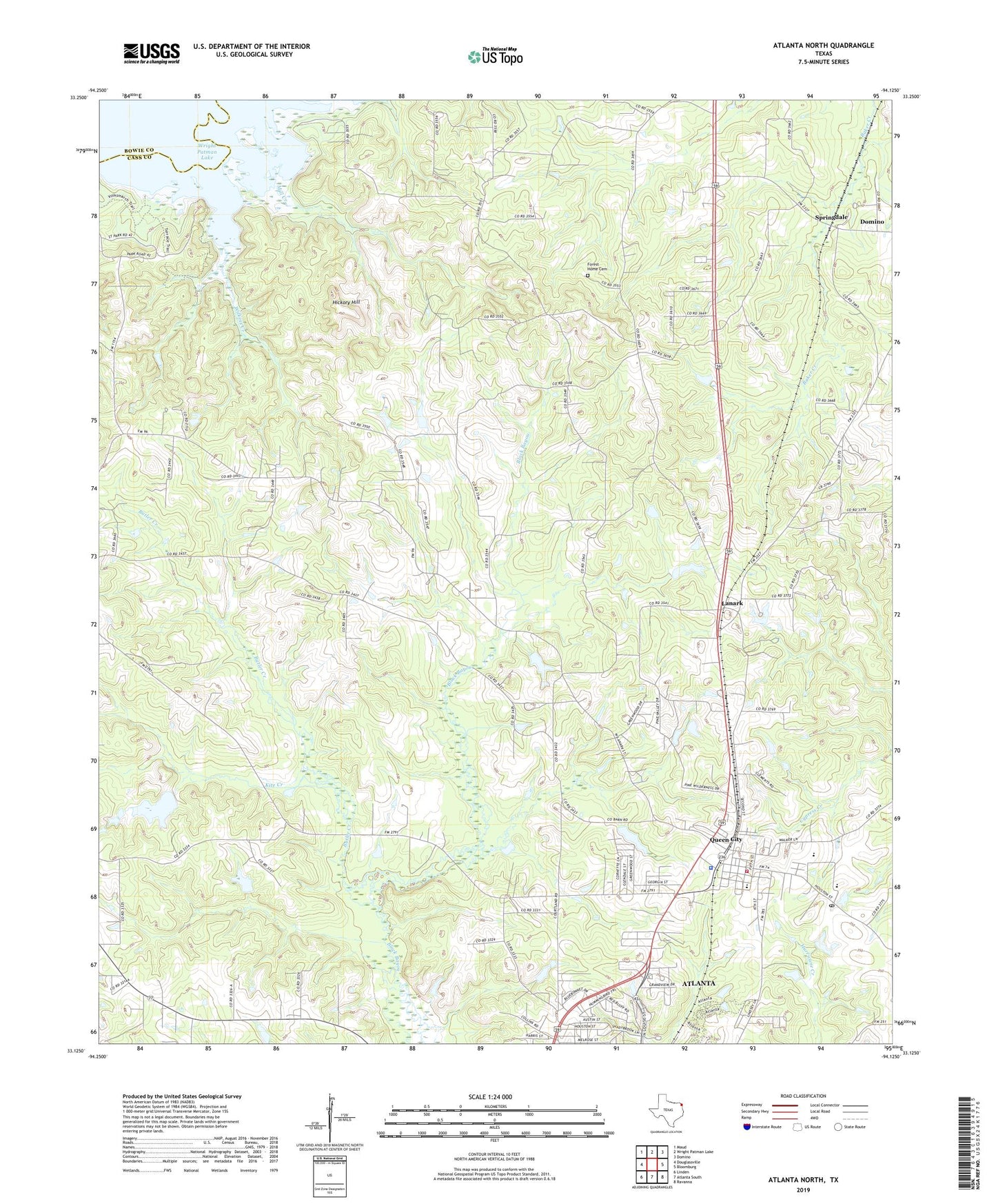
2022 topographic map quadrangle Atlanta North in the state of Texas. Scale: 1:24000. Based on the newly updated USGS 7.5' US Topo map series, this map is in the following counties: Cass, Bowie. The map contains contour data, water features, and other items you are used to seeing on USGS maps, but also has updated roads and other features. This is the next generation of topographic maps. Printed on high-quality waterproof paper with UV fade-resistant inks.
Quads adjacent to this one:
West: Douglassville
Northwest: Maud
North: Wright Patman Lake
Northeast: Domino
East: Bloomburg
Southeast: Ravanna
South: Atlanta South
Southwest: Linden
This map covers the same area as the classic USGS quad with code o33094b2.
Contains the following named places: Atlanta City Park, Atlanta Division, Atlanta State Park, Butler Creek, Cass County Fire District Station 2, City of Queen City, Country Place Community Baptist Church, Courtland Church, Elmo R Willard Branch Library, Forest Home Cemetery, Hendrick Temple Church of God in Christ, Hickory Hill, Hogan Lake, Hogan Lake Dam, Honey Grove Church, J K Hileman Elementary School, Kite Creek, Lanark, Lifenet Ambulance Service Post 70, Mathews-Powell House, Mill Creek, Morris Upchurch Middle School, Mount Zion Church, Piney Grove Church, Queen City, Queen City City Hall, Queen City High School, Queen City Police Department, Queen City Post Office, Shady Grove Church, Springdale, Springdale Church, Wilkins Creek, Wright Patman Lake, ZIP Code: 75572