MyTopo
Driscoll West Texas US Topo Map
Couldn't load pickup availability
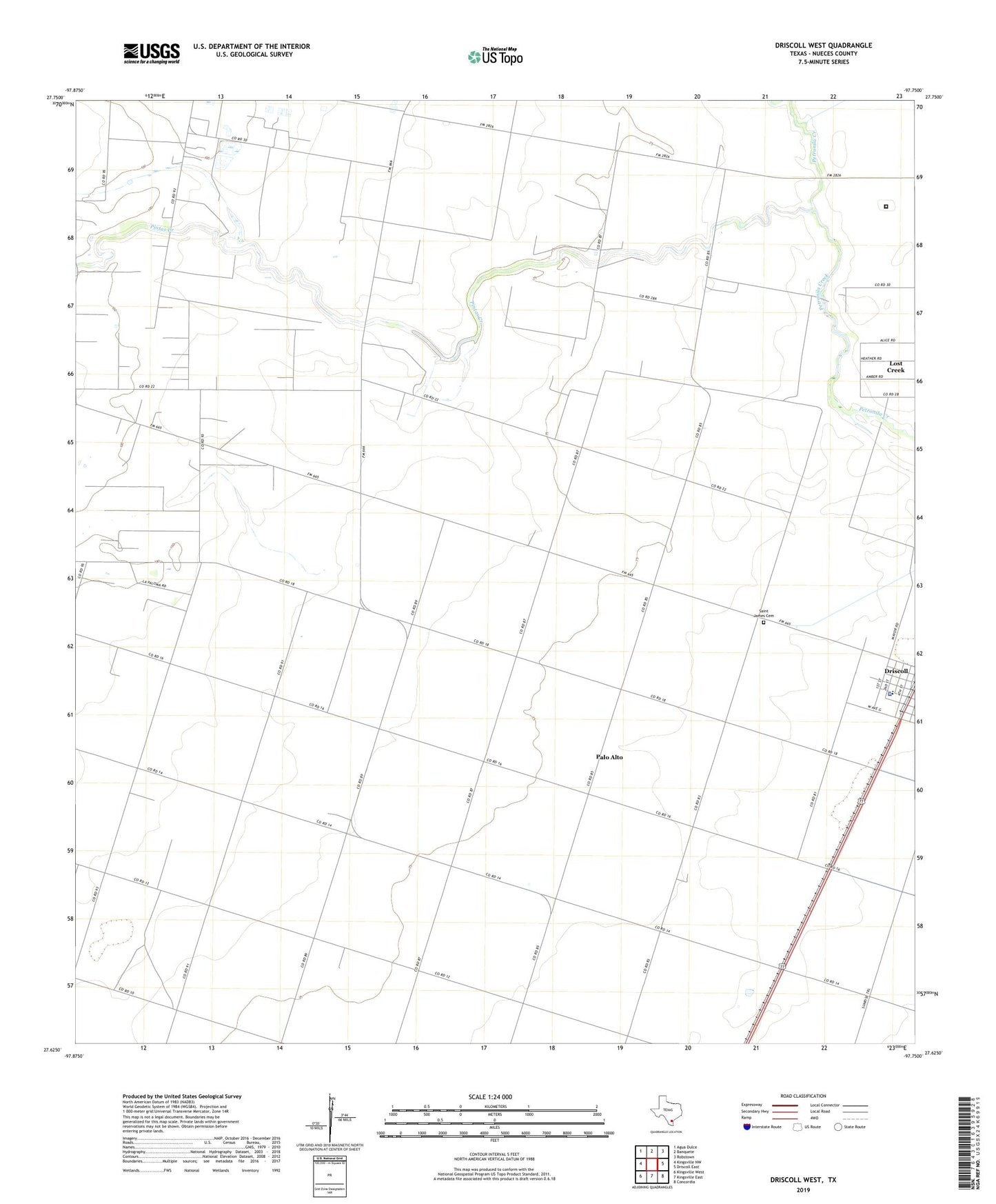
2022 topographic map quadrangle Driscoll West in the state of Texas. Scale: 1:24000. Based on the newly updated USGS 7.5' US Topo map series, this map is in the following counties: Nueces. The map contains contour data, water features, and other items you are used to seeing on USGS maps, but also has updated roads and other features. This is the next generation of topographic maps. Printed on high-quality waterproof paper with UV fade-resistant inks.
Quads adjacent to this one:
West: Kingsville NW
Northwest: Agua Dulce
North: Banquete
Northeast: Robstown
East: Driscoll East
Southeast: Concordia
South: Kingsville East
Southwest: Kingsville West
This map covers the same area as the classic USGS quad with code o27097f7.
Contains the following named places: Agua Dulce Pumping Station, Bishop Division, City of Driscoll, Coastal Bend Detention Center, Driscoll City Hall, Driscoll Elementary School, Driscoll Police Department, Driscoll Post Office, Harlan Tank Farm, KBIC-FM (Alice), La Paloma-Lost Creek Census Designated Place, Lost Creek, Palo Alto, Perry Foundation, Pintas Creek, Robstown Pumping Station, Saint James Cemetery, TGP 1 Heliport, ZIP Code: 78351