MyTopo
Dunbar Draw SE Texas US Topo Map
Couldn't load pickup availability
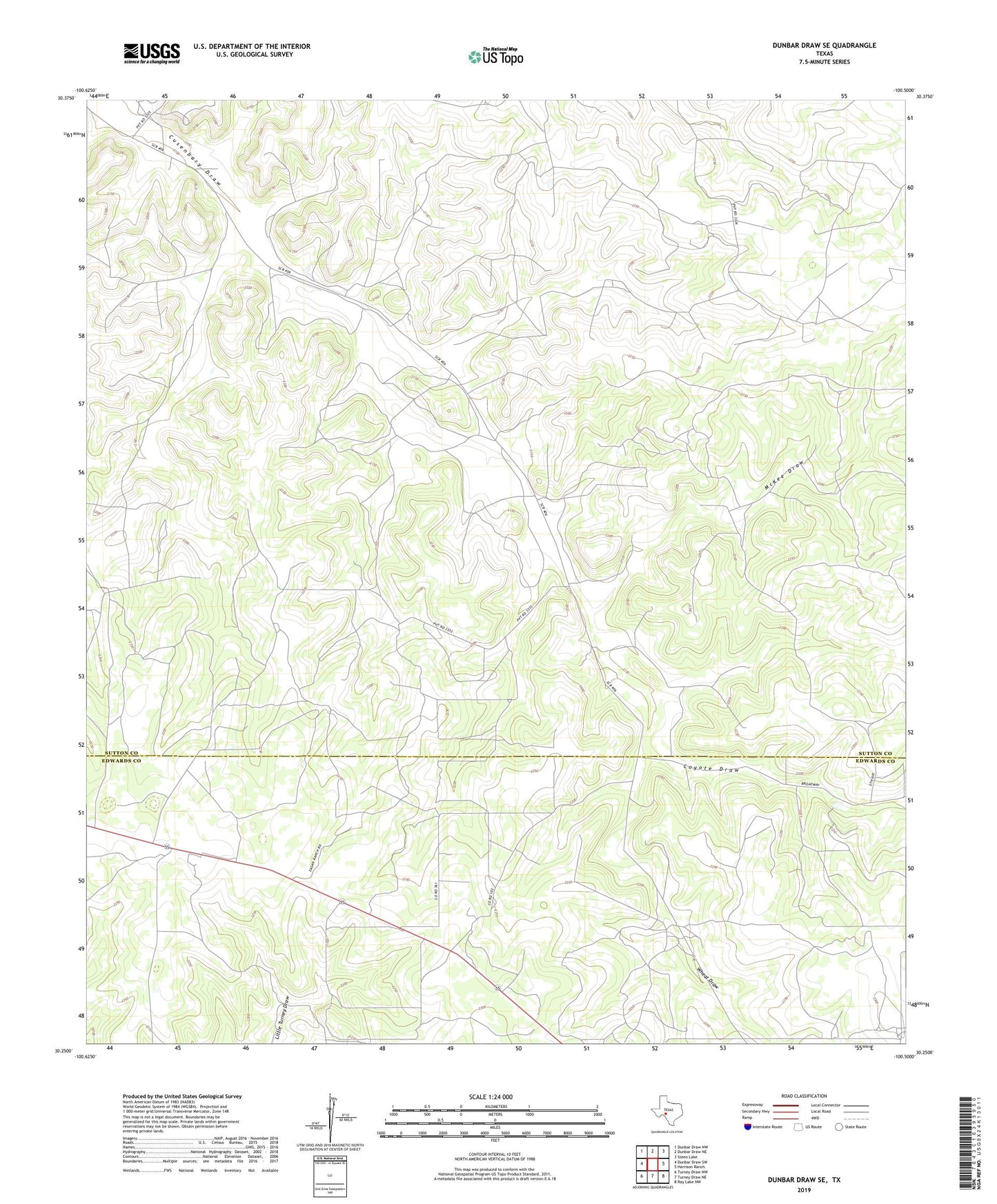
2022 topographic map quadrangle Dunbar Draw SE in the state of Texas. Scale: 1:24000. Based on the newly updated USGS 7.5' US Topo map series, this map is in the following counties: Sutton, Edwards. The map contains contour data, water features, and other items you are used to seeing on USGS maps, but also has updated roads and other features. This is the next generation of topographic maps. Printed on high-quality waterproof paper with UV fade-resistant inks.
Quads adjacent to this one:
West: Dunbar Draw SW
Northwest: Dunbar Draw NW
North: Dunbar Draw NE
Northeast: Steen Lake
East: Harrison Ranch
Southeast: Ray Lake NW
South: Turney Draw NE
Southwest: Turney Draw NW
This map covers the same area as the classic USGS quad with code o30100c5.
Contains the following named places: Ben Cusenbary Ranch, Coyote Draw, Epps Ranch, Holman Oil Field, McKee Draw, Merk Ranch, Morris Ranch, Rex Cusenbary Ranch, Texas A and M Experimental Station, Wheat Draw