MyTopo
Turney Draw NW Texas US Topo Map
Couldn't load pickup availability
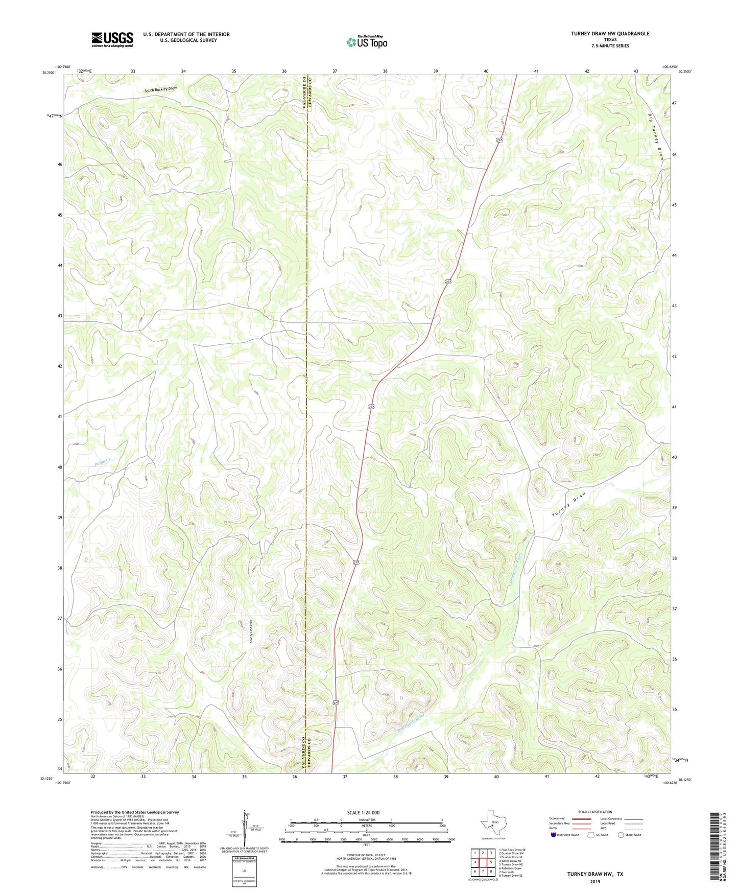
2022 topographic map quadrangle Turney Draw NW in the state of Texas. Scale: 1:24000. Based on the newly updated USGS 7.5' US Topo map series, this map is in the following counties: Edwards, Val Verde. The map contains contour data, water features, and other items you are used to seeing on USGS maps, but also has updated roads and other features. This is the next generation of topographic maps. Printed on high-quality waterproof paper with UV fade-resistant inks.
Quads adjacent to this one:
West: White Draw NE
Northwest: Flat Rock Draw SE
North: Dunbar Draw SW
Northeast: Dunbar Draw SE
East: Turney Draw NE
Southeast: Turney Draw SE
South: Four Mills
Southwest: Robinson Draw
This map covers the same area as the classic USGS quad with code o30100b6.
Contains the following named places: Buckley Windmill, Corita Windmill, Earwood Ranch, Heifer Windmill, Kirkendall Windmill, Mutton Pasture Windmill, Turney Draw, Whitehead Ranch