
MyTopo
East Columbia Texas US Topo Map
Couldn't load pickup availability
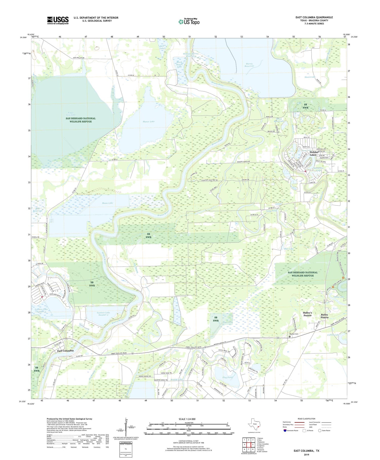
2019 topographic map quadrangle East Columbia in the state of Texas. Scale: 1:24000. Based on the newly updated USGS 7.5' US Topo map series, this map is in the following counties: Brazoria. The map contains contour data, water features, and other items you are used to seeing on USGS maps, but also has updated roads and other features. This is the next generation of topographic maps. Printed on high-quality waterproof paper with UV fade-resistant inks.
Quads adjacent to this one:
West: West Columbia
Northwest: Damon
North: Otey
Northeast: Rosharon
East: Angleton
Southeast: Lake Jackson
South: Brazoria
Southwest: Sweeny
Contains the following named places: Ammon Underwood House, Bailey Prairie, Bar X Ranch Lake, Bar X Ranch Lake Levee, Beal Reservoir, Beal Reservoir Levee, Bell Lake, Bintliff Lake, Bintliff Lake Levee, Black Ranch Lake, Black Ranch Lake Levee, Blue Lake, Brazoria Community Library, Collins Lake, Columbia Lakes Heliport, Columbia Lakes Volunteer Fire Department, Copper Bayou, Eagle Nest Lake, East Columbia, East Columbia Census Designated Place, East Columbia Historic District, Flag Pond, Green Hill Church, Griffith Reservoir, Griffith Reservoir Levee, Harris Reservoir, Hog Lake, Holiday Lakes, Holiday Lakes Fire Department, Holiday Lakes Municipal Building, Horseshoe Lake, Lagoon Reservoir, Lagoon Reservoir Dam, Long Pond, Mann Lake, Mann Lake Dam, Manor Lake, Mount Pisgah Church, Mount Zion Church, Munson Cemetery, Munson Lake, Saint Joseph Church, Sally Lake, Scoby Lake, Senna Bean Lake, Snag Lake, Tenneco Lake Number 1, Tenneco Lake Number 1 Levee, Tenneco Lake Number 2, Tenneco Lake Number 2 Levee, Town of Holiday Lakes, Trunk Lake, Varner Creek, William Harris Reservoir, William Harris Reservoir Dam


