MyTopo
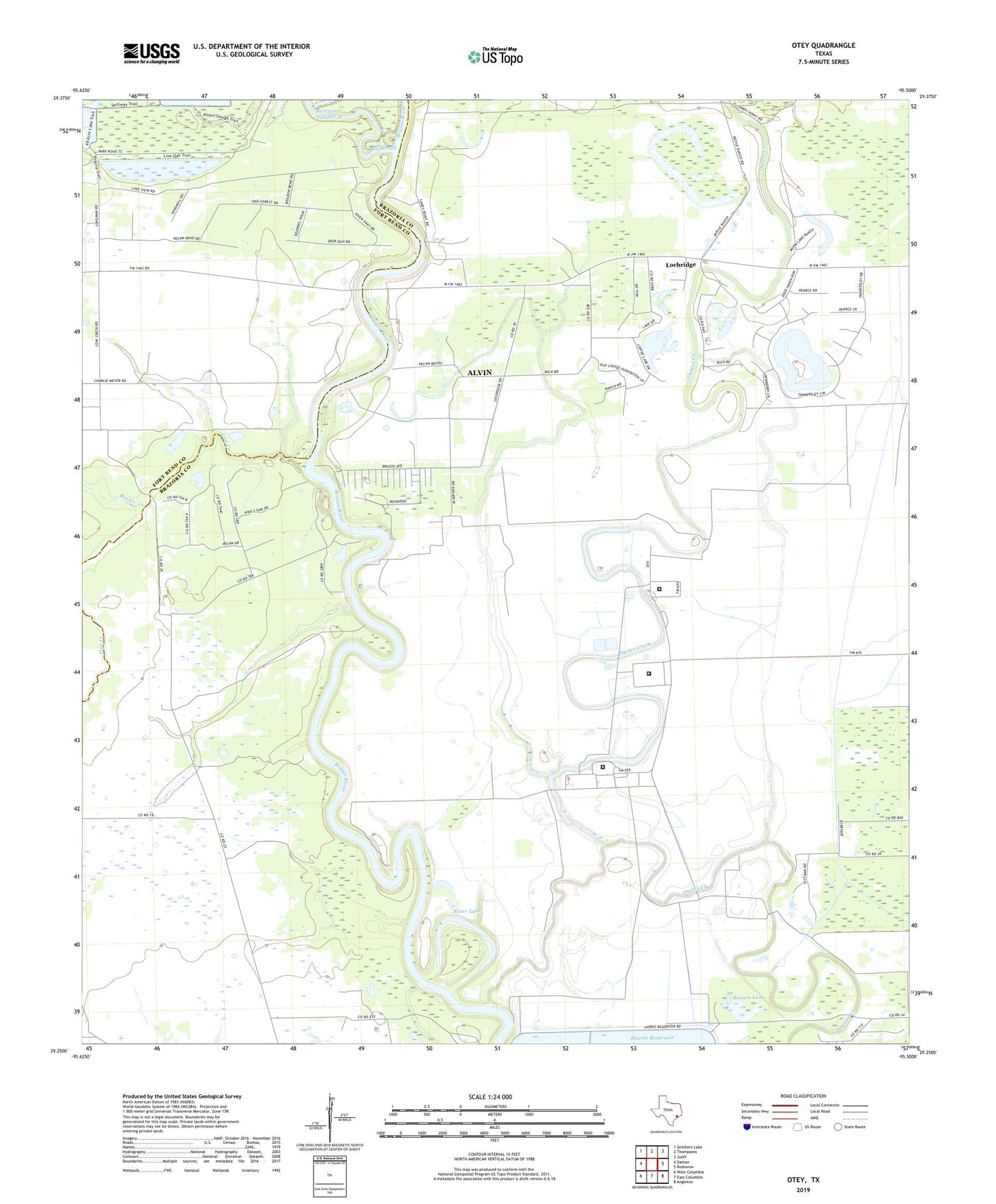
Otey Texas US Topo Map
Couldn't load pickup availability
2022 topographic map quadrangle Otey in the state of Texas. Scale: 1:24000. Based on the newly updated USGS 7.5' US Topo map series, this map is in the following counties: Brazoria, Fort Bend. The map contains contour data, water features, and other items you are used to seeing on USGS maps, but also has updated roads and other features. This is the next generation of topographic maps. Printed on high-quality waterproof paper with UV fade-resistant inks.
Quads adjacent to this one:
West: Damon
Northwest: Smithers Lake
North: Thompsons
Northeast: Juliff
East: Rosharon
Southeast: Angleton
South: East Columbia
Southwest: West Columbia
This map covers the same area as the classic USGS quad with code o29095c5.
Contains the following named places: Barnes Lake, Bee Creek, Bethelder Baptist Church, Big Creek, Coffee Lake, Cow Creek, English, Genther Station, Hale Ranch State Park Reservoir Number 8 Dam, Lochridge, Mount Olive Baptist Church, Orozimbo, Otey, River Lake, Saint James Church, Tankersley Lake, Texas Department of Criminal Justice A M Mac Stringfellow Unit, Texas Department of Criminal Justice C T Terrell Unit, Texas Department of Criminal Justice W F Ramsey Unit