MyTopo
West Columbia Texas US Topo Map
Couldn't load pickup availability
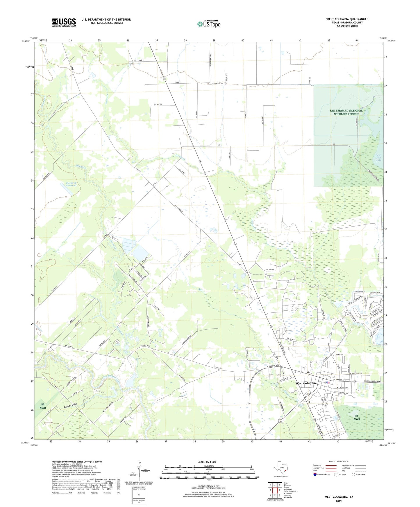
2022 topographic map quadrangle West Columbia in the state of Texas. Scale: 1:24000. Based on the newly updated USGS 7.5' US Topo map series, this map is in the following counties: Brazoria. The map contains contour data, water features, and other items you are used to seeing on USGS maps, but also has updated roads and other features. This is the next generation of topographic maps. Printed on high-quality waterproof paper with UV fade-resistant inks.
Quads adjacent to this one:
West: Danciger
Northwest: Guy
North: Damon
Northeast: Otey
East: East Columbia
Southeast: Brazoria
South: Sweeny
Southwest: Ashwood
This map covers the same area as the classic USGS quad with code o29095b6.
Contains the following named places: Blackwell Reservoir, Blackwell Reservoir Levee, Brazoria County Constable's Office Precinct 4, Brazoria County Juvenile Justice Alternative Education Program, Cannon Gully, Central Emergency Medical Services, Charlie Brown Intermediate School (closed), City of West Columbia, Columbia High School, Columbia Historical Museum Association, Light House Christian Academy, Mound Creek, Saint Paul Church, Varner Hogg Plantation State Historical Park, West Columbia, West Columbia City Hall, West Columbia Elementary School, West Columbia Fire Marshal's Office, West Columbia Independent School District Football Stadium, West Columbia Junior High School (closed), West Columbia Oil Field, West Columbia Police Department, West Columbia Post Office, West Columbia Volunteer Fire Department, Williams Lake Number 1, Williams Lake Number 1 Levee, Williams Lake Number 2, Williams Lake Number 2 Levee, ZIP Code: 77486