MyTopo
Sweeny Texas US Topo Map
Couldn't load pickup availability
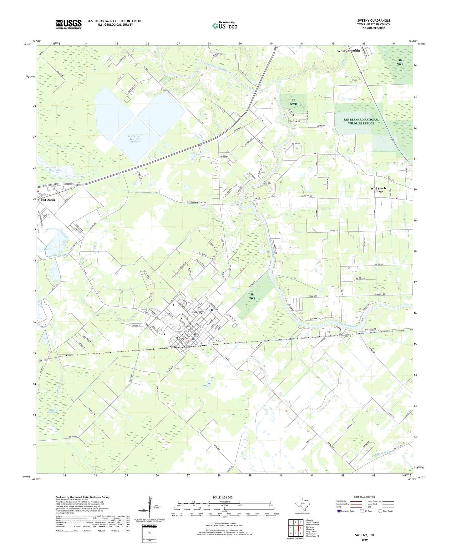
2022 topographic map quadrangle Sweeny in the state of Texas. Scale: 1:24000. Based on the newly updated USGS 7.5' US Topo map series, this map is in the following counties: Brazoria. The map contains contour data, water features, and other items you are used to seeing on USGS maps, but also has updated roads and other features. This is the next generation of topographic maps. Printed on high-quality waterproof paper with UV fade-resistant inks.
Quads adjacent to this one:
West: Ashwood
Northwest: Danciger
North: West Columbia
Northeast: East Columbia
East: Brazoria
Southeast: Cedar Lane NE
South: Cedar Lane
Southwest: Bay City NE
This map covers the same area as the classic USGS quad with code o29095a6.
Contains the following named places: Bell Creek, Brazoria County Juvenile Justice Alternative Education Program, Brazoria-West Columbia Division, City of Sweeny, El Bernardo, Flag Pond, Four Corners, Markle Lake, Markle Lake Levee, Old Ocean, Old Ocean Oil Field, Old Ocean Swamp, Old Ocean Volunteer Fire Department, San Bernard Reservoir Number 1, San Bernard Reservoir Number 1 Levee, San Bernard Reservoir Number 2, San Bernard Reservoir Number 2 Levee, San Bernard Reservoir Number 3, San Bernard Reservoir Number 3 Levee, Sweeney City Hall, Sweeny, Sweeny Christian School, Sweeny Community Hospital, Sweeny Elementary School, Sweeny Fire and Rescue, Sweeny High School, Sweeny Junior High School, Sweeny Optional School, Sweeny Police Department, Sweeny Post Office, Washington Chapel, Wild Peach Village, Wild Peach Village Census Designated Place, Wild Peach Volunteer Fire Department, Wilson Point Church