MyTopo
Rosharon Texas US Topo Map
Couldn't load pickup availability
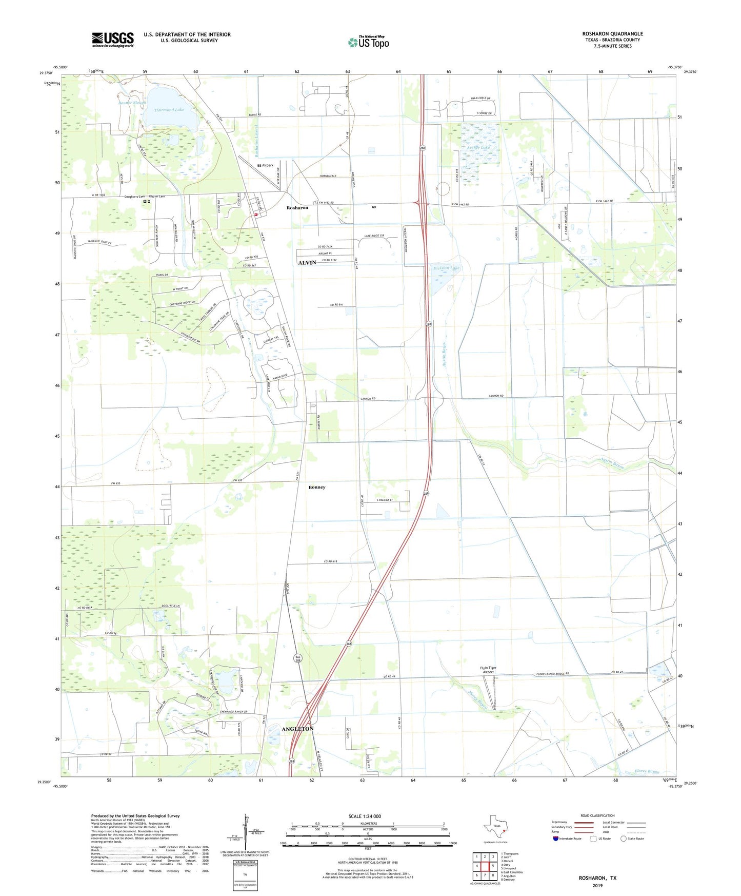
2022 topographic map quadrangle Rosharon in the state of Texas. Scale: 1:24000. Based on the newly updated USGS 7.5' US Topo map series, this map is in the following counties: Brazoria. The map contains contour data, water features, and other items you are used to seeing on USGS maps, but also has updated roads and other features. This is the next generation of topographic maps. Printed on high-quality waterproof paper with UV fade-resistant inks.
Quads adjacent to this one:
West: Otey
Northwest: Thompsons
North: Juliff
Northeast: Manvel
East: Liverpool
Southeast: Danbury
South: Angleton
Southwest: East Columbia
This map covers the same area as the classic USGS quad with code o29095c4.
Contains the following named places: Archer Lake, Archer Lake Levee, BB Airpark, Bonner Slough, Bonney, Bonney Oil Field, Chenango, Chenango Plantation, Chenango Pond, China Grove, City of Alvin, Daughters Cemetery, Division Lake, Division Lake Levee, Ellon Church, Flyin Tiger Airport, Pilgrim Cemetery, Providence Church, Riceland Flying Service Airport, Rosharon, Rosharon Census Designated Place, Rosharon Lateral, Rosharon Post Office, Rosharon School, Rosharon Volunteer Fire Department, Thurmond Lake, Village of Bonney, Village of Bonney City Hall