MyTopo
Eden Texas US Topo Map
Couldn't load pickup availability
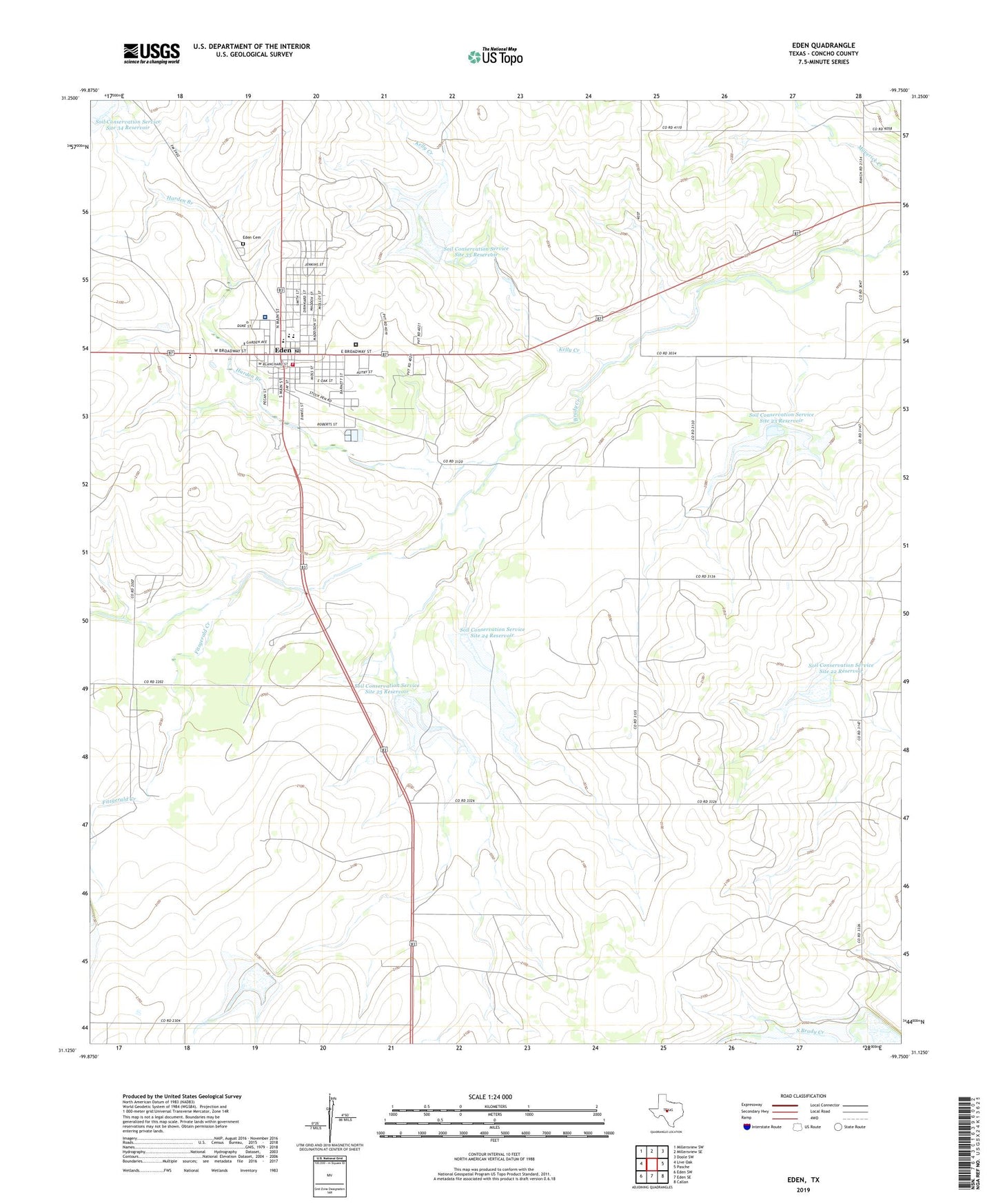
2022 topographic map quadrangle Eden in the state of Texas. Scale: 1:24000. Based on the newly updated USGS 7.5' US Topo map series, this map is in the following counties: Concho. The map contains contour data, water features, and other items you are used to seeing on USGS maps, but also has updated roads and other features. This is the next generation of topographic maps. Printed on high-quality waterproof paper with UV fade-resistant inks.
Quads adjacent to this one:
West: Live Oak
Northwest: Millersview SW
North: Millersview SE
Northeast: Doole SW
East: Pasche
Southeast: Callan
South: Eden SE
Southwest: Eden SW
This map covers the same area as the classic USGS quad with code o31099b7.
Contains the following named places: City of Eden, Concho County Hospital, Correctional Institution Eden, Eden, Eden Cemetery, Eden City Hall, Eden Emergency Medical Services Ambulance, Eden Police Department, Eden Post Office, Eden Volunteer Fire Department, Fitzgerald Creek, Harden Branch, Kelly Creek, Pfluger Park, Soil Conservation Service Site 20 Reservoir, Soil Conservation Service Site 22 Dam, Soil Conservation Service Site 22 Reservoir, Soil Conservation Service Site 23 Dam, Soil Conservation Service Site 23 Reservoir, Soil Conservation Service Site 24 Dam, Soil Conservation Service Site 24 Reservoir, Soil Conservation Service Site 25 Dam, Soil Conservation Service Site 25 Reservoir, Soil Conservation Service Site 27 Dam, Soil Conservation Service Site 27 Reservoir, Soil Conservation Service Site 34 Dam, Soil Conservation Service Site 34 Reservoir, Soil Conservation Service Site 35 Dam, Soil Conservation Service Site 35 Reservoir