MyTopo
Elbow Texas US Topo Map
Couldn't load pickup availability
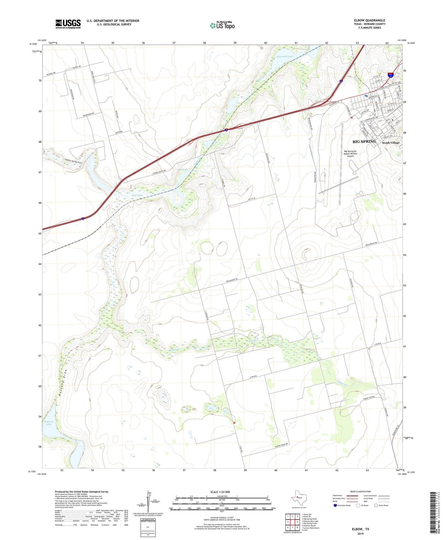
2022 topographic map quadrangle Elbow in the state of Texas. Scale: 1:24000. Based on the newly updated USGS 7.5' US Topo map series, this map is in the following counties: Howard. The map contains contour data, water features, and other items you are used to seeing on USGS maps, but also has updated roads and other features. This is the next generation of topographic maps. Printed on high-quality waterproof paper with UV fade-resistant inks.
Quads adjacent to this one:
West: Natural Dam Lake
Northwest: Knott SW
North: Knott SE
Northeast: Big Spring North
East: Big Spring South
Southeast: Lees
South: Lucian Wells Ranch
Southwest: Houston Ranch
This map covers the same area as the classic USGS quad with code o32101b5.
Contains the following named places: Air Evac Lifeteam 54, Big Spring Army Air Field, Big Spring Fire Department Station 1, Big Spring Mc Mahon-Wrinkle Airport, Big Spring Police Department, Elbow, Elbow Creek, Federal Correctional Institution Big Spring Facility, Fourmile Lake, Howard County Sheriff's Office, Howard County Volunteer Fire Department Lomax, Moore Oil Field, Mustang Draw, Roberts Lake, Salt Lake, Sulphur Springs Draw, Webb Air Force Base