MyTopo
Etoile North Texas US Topo Map
Couldn't load pickup availability
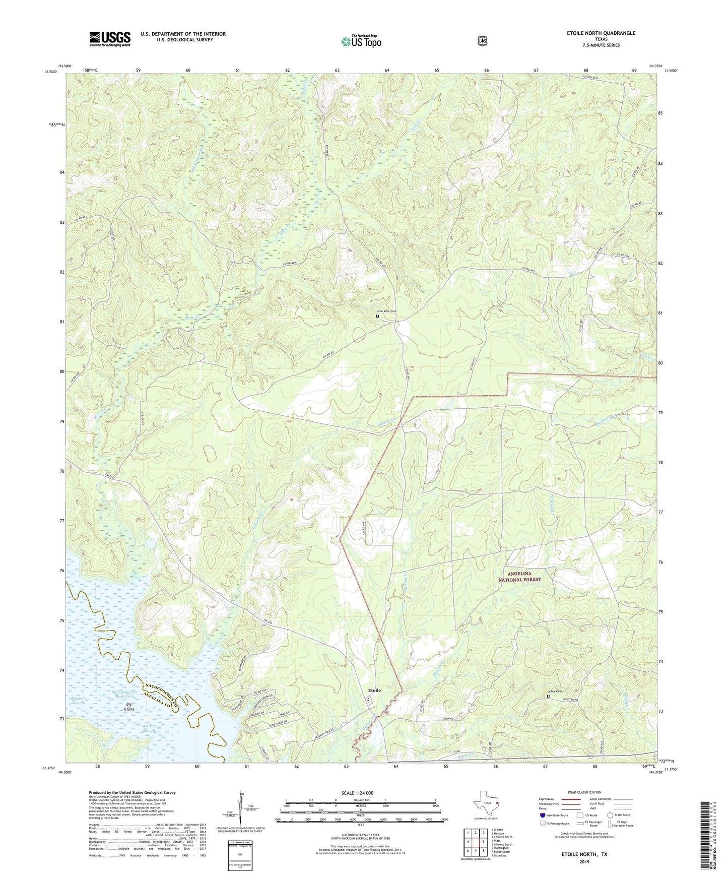
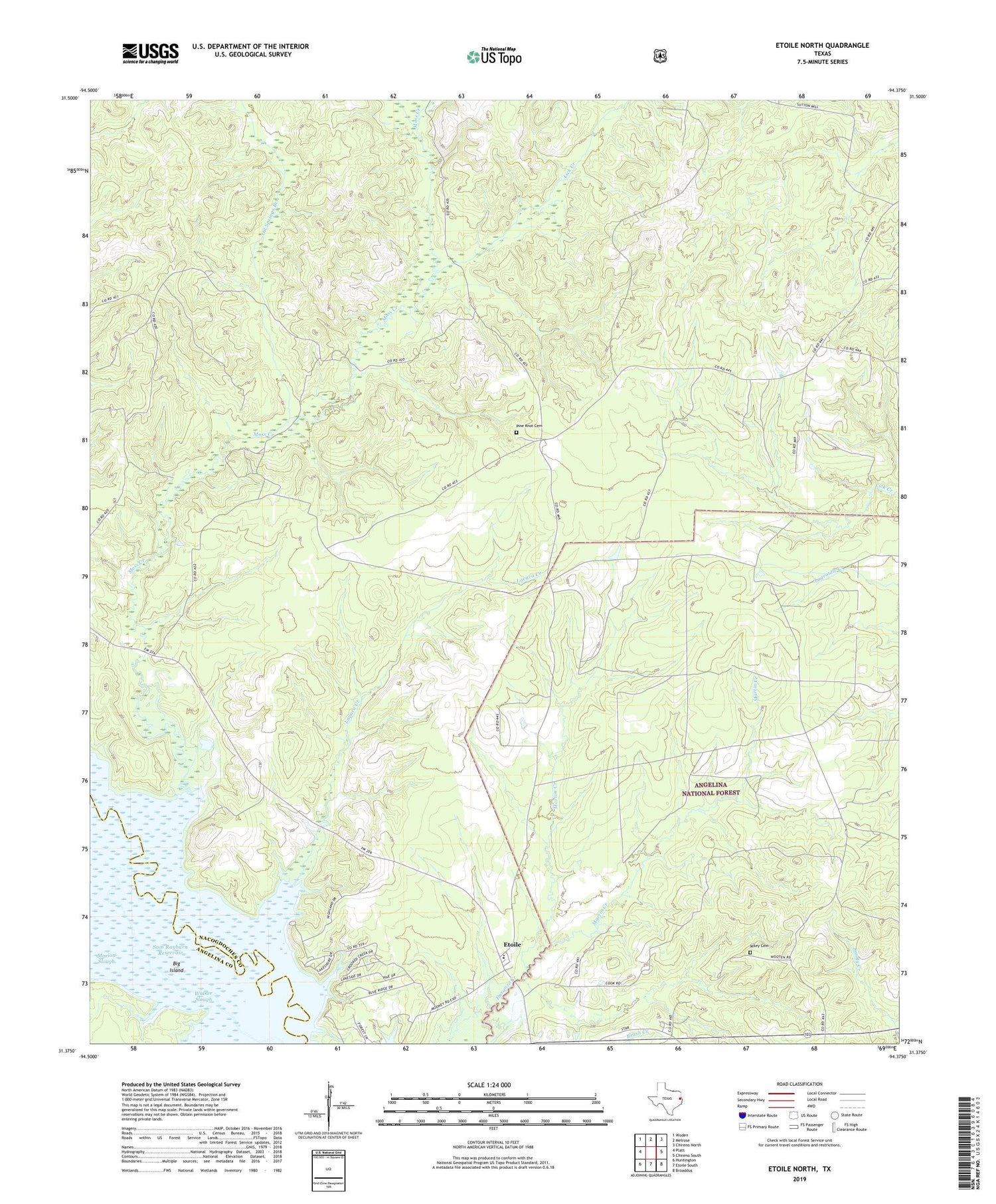
2019 topographic map quadrangle Etoile North in the state of Texas. Scale: 1:24000. Based on the newly updated USGS 7.5' US Topo map series, this map is in the following counties: Nacogdoches, Angelina. The map contains contour data, water features, and other items you are used to seeing on USGS maps, but also has updated roads and other features. This is the next generation of topographic maps. Printed on high-quality waterproof paper with UV fade-resistant inks.
Quads adjacent to this one:
West: Platt
Northwest: Woden
North: Melrose
Northeast: Chireno North
East: Chireno South
Southeast: Broaddus
South: Etoile South
Southwest: Huntington
Contains the following named places: Big Island, Chireno-Martinsville Division, Clear Springs, Etoile, Etoile Park, Etoile Park Campground, La Cerda, Lavaca Creek, Lick Creek, Marion Slough, Martin Creek, Miley Cemetery, Morton Creek, Moss Creek, New Camp, Oil Springs, Oil Springs Branch, Oil Springs Oil Field Discovery Well, Pine Knot Cemetery, Rector Creek, Suttons Mill, Terrapin Creek, Walker Slough