MyTopo
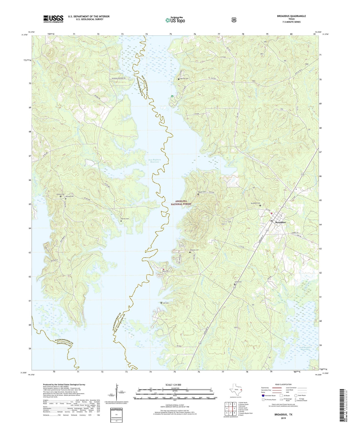
Broaddus Texas US Topo Map
Couldn't load pickup availability
Also explore the Broaddus Forest Service Topo of this same quad for updated USFS data
2022 topographic map quadrangle Broaddus in the state of Texas. Scale: 1:24000. Based on the newly updated USGS 7.5' US Topo map series, this map is in the following counties: San Augustine, Nacogdoches, Angelina. The map contains contour data, water features, and other items you are used to seeing on USGS maps, but also has updated roads and other features. This is the next generation of topographic maps. Printed on high-quality waterproof paper with UV fade-resistant inks.
Quads adjacent to this one:
West: Etoile South
Northwest: Etoile North
North: Chireno South
Northeast: Norwood
East: Harvey Creek
Southeast: Veach
South: Cassells-Boykin Park
Southwest: Zavalla
This map covers the same area as the classic USGS quad with code o31094c3.
Contains the following named places: Attoyac Property Owners Volunteer Fire Department, Beech Branch, Boggy Creek, Brewers Chapel, Broaddus, Broaddus Cemetery, Broaddus Post Office, Broaddus Volunteer Fire Department, Bullet Creek, Caney Creek, Cedar Creek, Fox Cemetery, Harvey Cemetery, Harvy Cemetery, Horseshoe Lake, Jackson Hill Lookout, Jackson Hill Park, Lee Cemetery, Lowery Cemetery, Owl Creek, Prairie Creek, Priority One Emergency Medical Service, Saint Peter Church, Salt Lake, Sandy Creek, Shirley Creek Campground, Smyrna Cemetery, Sowell Cemetery, Town of Broaddus, Townsend, Townsend Recreation Site, Ware Branch, Williams Cemetery