MyTopo
Fischer Texas US Topo Map
Couldn't load pickup availability
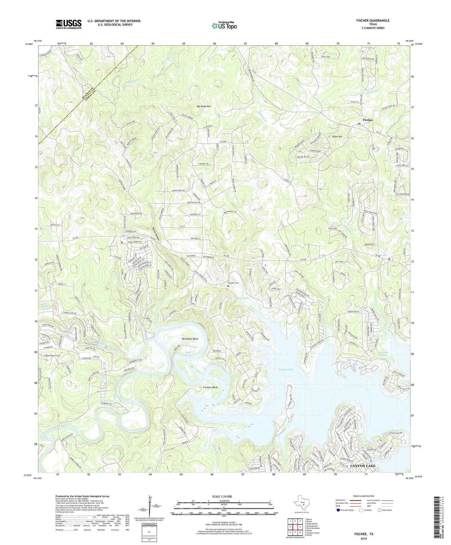
2019 topographic map quadrangle Fischer in the state of Texas. Scale: 1:24000. Based on the newly updated USGS 7.5' US Topo map series, this map is in the following counties: Comal, Blanco. The map contains contour data, water features, and other items you are used to seeing on USGS maps, but also has updated roads and other features. This is the next generation of topographic maps. Printed on high-quality waterproof paper with UV fade-resistant inks.
Quads adjacent to this one:
West: Spring Branch
Northwest: Blanco
North: Payton
Northeast: Rough Hollow
East: Devils Backbone
Southeast: Sattler
South: Smithson Valley
Southwest: Anhalt
Contains the following named places: Big Head Mountain, Bishop Spring, Bremer Cemetery, Canyon Lake, Canyon Lake Census Designated Place, Canyon Lake Fire and EMS Station 53, Cordova Bend, Cranes Mill, Cranes Mill Park, Cranes Mill Springs, Demijohn Bend, Devils Hollow, Fischer, Fischer Post Office, Jentsch Creek, Kuhn Hill, Potter Creek, Potter Creek Park, Rebecca Creek, Rebecca Springs, Rust Falls, Schultz Creek, Spring Branch Volunteer Fire Department Station 2, Wolfe Springs