MyTopo
Spring Branch Texas US Topo Map
Couldn't load pickup availability
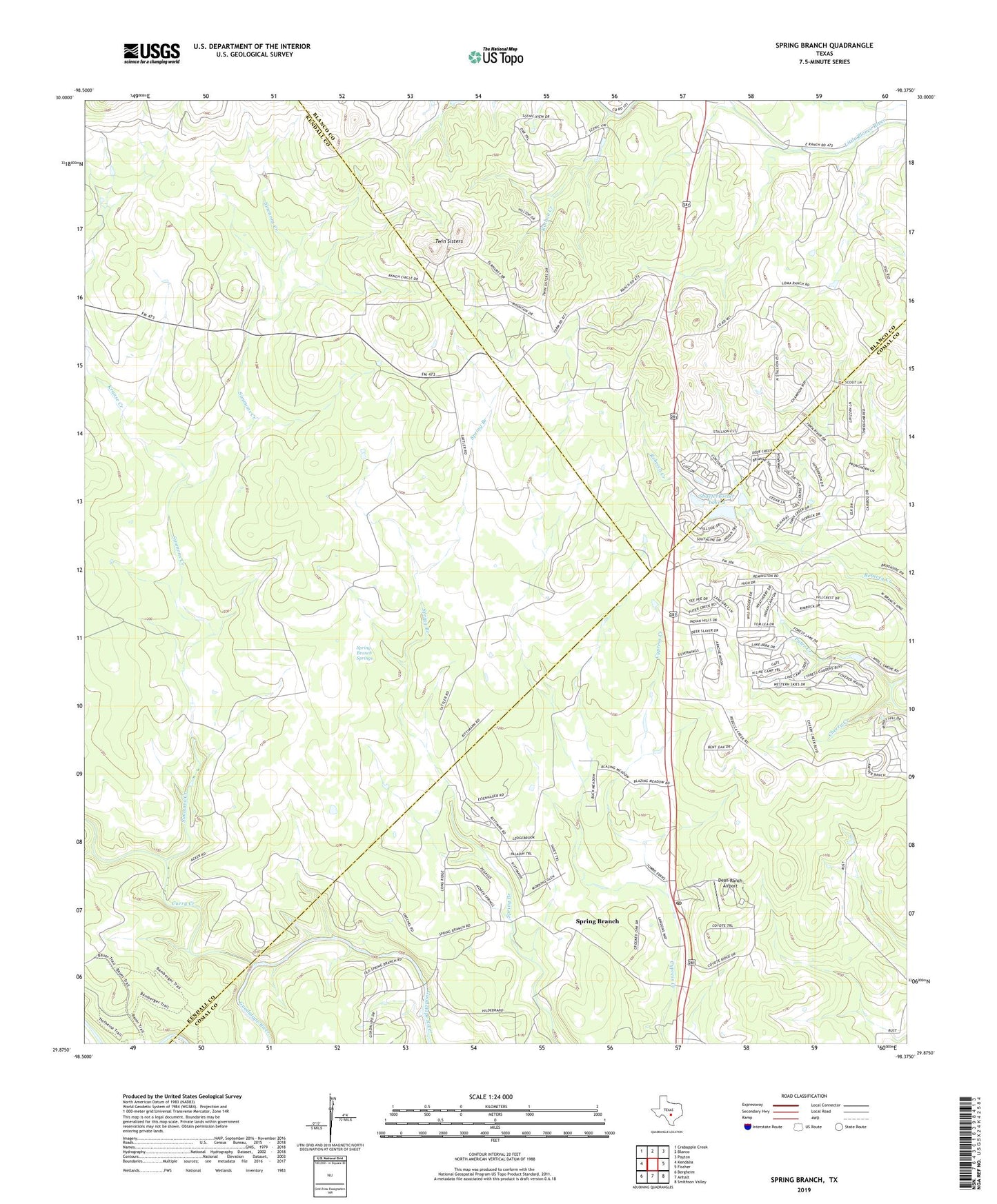
2022 topographic map quadrangle Spring Branch in the state of Texas. Scale: 1:24000. Based on the newly updated USGS 7.5' US Topo map series, this map is in the following counties: Comal, Kendall, Blanco. The map contains contour data, water features, and other items you are used to seeing on USGS maps, but also has updated roads and other features. This is the next generation of topographic maps. Printed on high-quality waterproof paper with UV fade-resistant inks.
Quads adjacent to this one:
West: Kendalia
Northwest: Crabapple Creek
North: Blanco
Northeast: Payton
East: Fischer
Southeast: Smithson Valley
South: Anhalt
Southwest: Bergheim
This map covers the same area as the classic USGS quad with code o29098h4.
Contains the following named places: Cherry Creek, Curry Creek, Dean Ranch Airport, Double U Ranch Airport, Krause Creek, Puter Creek, Rochou Creek, Saint Mary Church, Shaeferkoeter Dam 2, Shaeferkoeter Lake 2, Simmons Creek, Spring Branch, Spring Branch Post Office, Spring Branch Springs, Spring Branch Volunteer Fire Department Central Station, Twin Sisters, ZIP Code: 78070