MyTopo
Blanco Texas US Topo Map
Couldn't load pickup availability
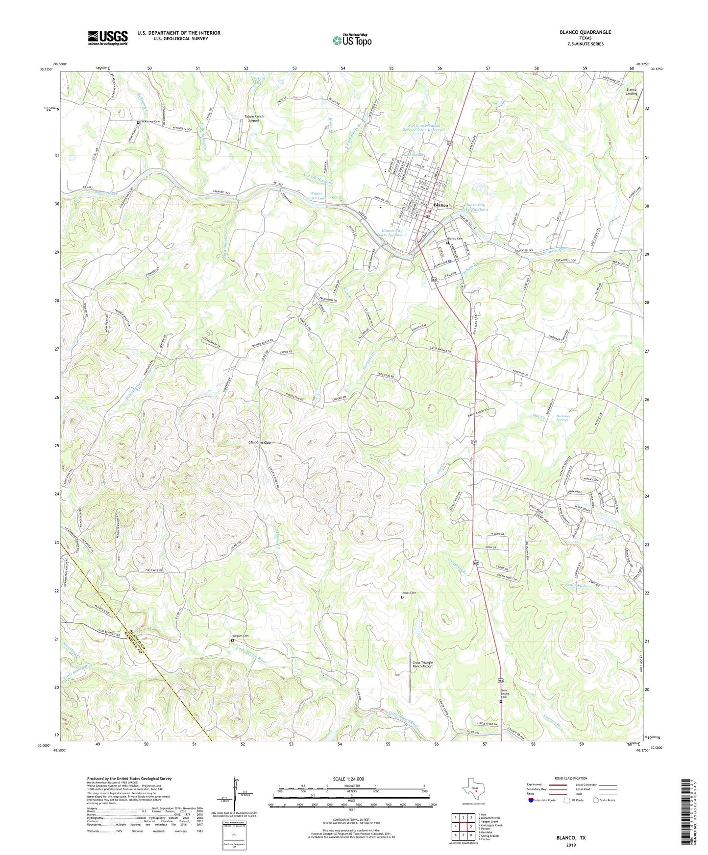
2022 topographic map quadrangle Blanco in the state of Texas. Scale: 1:24000. Based on the newly updated USGS 7.5' US Topo map series, this map is in the following counties: Blanco, Kendall. The map contains contour data, water features, and other items you are used to seeing on USGS maps, but also has updated roads and other features. This is the next generation of topographic maps. Printed on high-quality waterproof paper with UV fade-resistant inks.
Quads adjacent to this one:
West: Crabapple Creek
Northwest: Hye
North: Monument Hill
Northeast: Yeager Creek
East: Payton
Southeast: Fischer
South: Spring Branch
Southwest: Kendalia
This map covers the same area as the classic USGS quad with code o30098a4.
Contains the following named places: Adrian Edwards Conn House, August Jonas Cemetery, Beckman Springs, Blanco, Blanco Cemetery, Blanco City Dam Number 1, Blanco City Hall, Blanco City Lake Number 1, Blanco County Constable's Office Precinct 4, Blanco County Emergency Services District 2, Blanco Division, Blanco Historic District, Blanco Police Department, Blanco Post Office, Blanco State Park, Blanco State Park Trail, Blanco Volunteer Ambulance, Blasingame Creek, City of Blanco, Cottonwood Creek, Cross Triangle Ranch Airport, Durham Branch, East Fork Hinds Branch, Hereford Hills Ranch, Hinds Branch, Koch Branch, Koch Springs, Manahan Creek, McKinney Cemetery, McKinney Creek, Schuetz Creek, Soil Conservation Service Site 1 Dam, Soil Conservation Service Site 1 Reservoir, Stubbins Gap, Tatum Lake, Tatum Ranch Airport, Twin Sisters, Twin Sisters Cemetery, Wayne Smith Dam, Wayne Smith Lake, WE Four Ranch, Wegner Cemetery, West Fork Hinds Branch, ZIP Code: 78606