MyTopo
Fordtran Texas US Topo Map
Couldn't load pickup availability
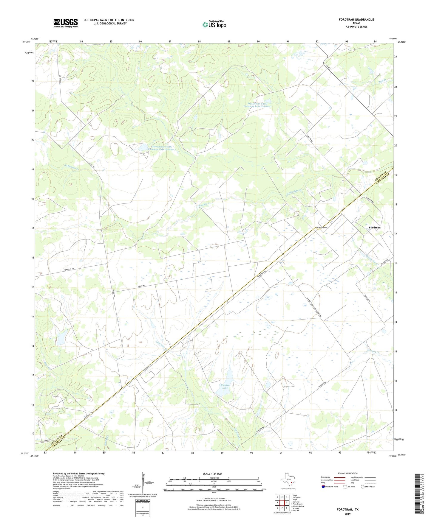
2022 topographic map quadrangle Fordtran in the state of Texas. Scale: 1:24000. Based on the newly updated USGS 7.5' US Topo map series, this map is in the following counties: DeWitt, Victoria. The map contains contour data, water features, and other items you are used to seeing on USGS maps, but also has updated roads and other features. This is the next generation of topographic maps. Printed on high-quality waterproof paper with UV fade-resistant inks.
Quads adjacent to this one:
West: Verhelle
Northwest: Edgar
North: Terryville
Northeast: Hope
East: Peck Branch
Southeast: Inez NW
South: Nursery
Southwest: Mission Valley
This map covers the same area as the classic USGS quad with code o29097a1.
Contains the following named places: Barry Oil Field, Fordtran, Helen Gohlke Oil Field, Kuester Lake, Kuester Lake Dam, Musselman Cattle Company Dam Number 1, Musselman Cattle Company Dam Number 2, Musselman Cattle Company Lake Number 1, Musselman Cattle Company Lake Number 2, South Chicolete Creek