MyTopo
Forest Texas US Topo Map
Couldn't load pickup availability
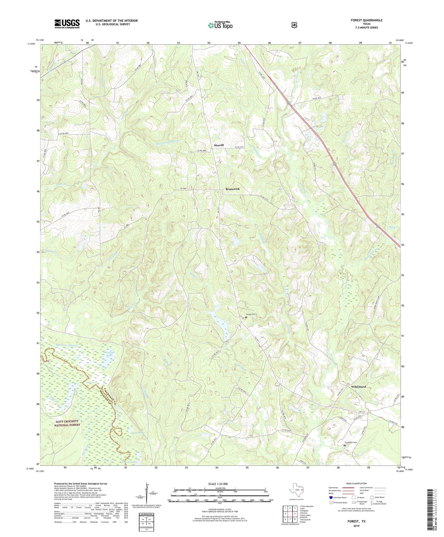
2019 topographic map quadrangle Forest in the state of Texas. Scale: 1:24000. Based on the newly updated USGS 7.5' US Topo map series, this map is in the following counties: Cherokee, Houston. The map contains contour data, water features, and other items you are used to seeing on USGS maps, but also has updated roads and other features. This is the next generation of topographic maps. Printed on high-quality waterproof paper with UV fade-resistant inks.
Quads adjacent to this one:
West: Weches
Northwest: Pryor Mountain
North: Alto
Northeast: Douglass
East: Durst Lakes
Southeast: Wells
South: Kennard NE
Southwest: Ratcliff
Contains the following named places: Arnold Cemetery, Barsola Church, Big Springs, Black Creek, Brunswick, Camp Creek, Cold Springs, Cotton Branch, Deep Hole, Forest, Grassy Pond, Holloway Lake, Holloway Lake Dam, Mathis Mill Branch, McCall Lake, McGill Hole, McLain Branch, Morrill, Morrill Fish Pond Branch, Old River Channel, Pole Crossing, Sandy Branch, Sawmill Branch, Scurlocks Camp, Shaw Branch, Sulphur Creek, The Whirl, Thompson Cemetery, Upper Lake, Wells Division, Wild Hurst, Wire Creek, ZIP Code: 75925