MyTopo
Durst Lakes Texas US Topo Map
Couldn't load pickup availability
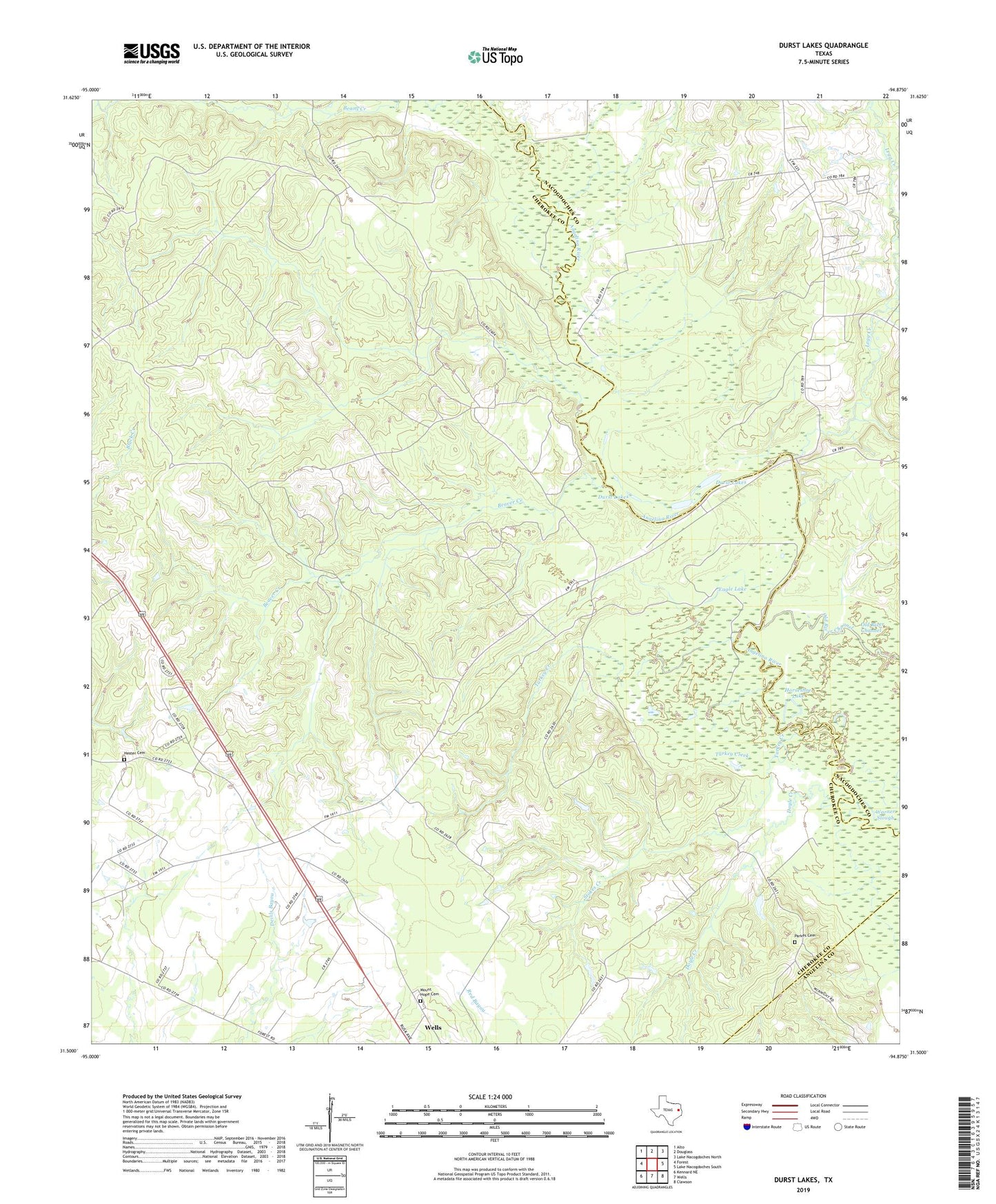
2022 topographic map quadrangle Durst Lakes in the state of Texas. Scale: 1:24000. Based on the newly updated USGS 7.5' US Topo map series, this map is in the following counties: Cherokee, Nacogdoches, Angelina. The map contains contour data, water features, and other items you are used to seeing on USGS maps, but also has updated roads and other features. This is the next generation of topographic maps. Printed on high-quality waterproof paper with UV fade-resistant inks.
Quads adjacent to this one:
West: Forest
Northwest: Alto
North: Douglass
Northeast: Lake Nacogdoches North
East: Lake Nacogdoches South
Southeast: Clawson
South: Wells
Southwest: Kennard NE
This map covers the same area as the classic USGS quad with code o31094e8.
Contains the following named places: Beans Creek, Beaver Creek, Cross Roads, Doyle Creek, Durst Lakes, Eagle Lake, Hester Cemetery, Horseshoe Lake, Kateschapel, King Creek, Legg Creek, Mill Creek, Mitchell Slough, Mount Hope Cemetery, Parkes Cemetery, Stokes Creek, Turkey Creek, Walker Creek, Warner Slough, ZIP Code: 75976