MyTopo
Franklin Lake Texas US Topo Map
Couldn't load pickup availability
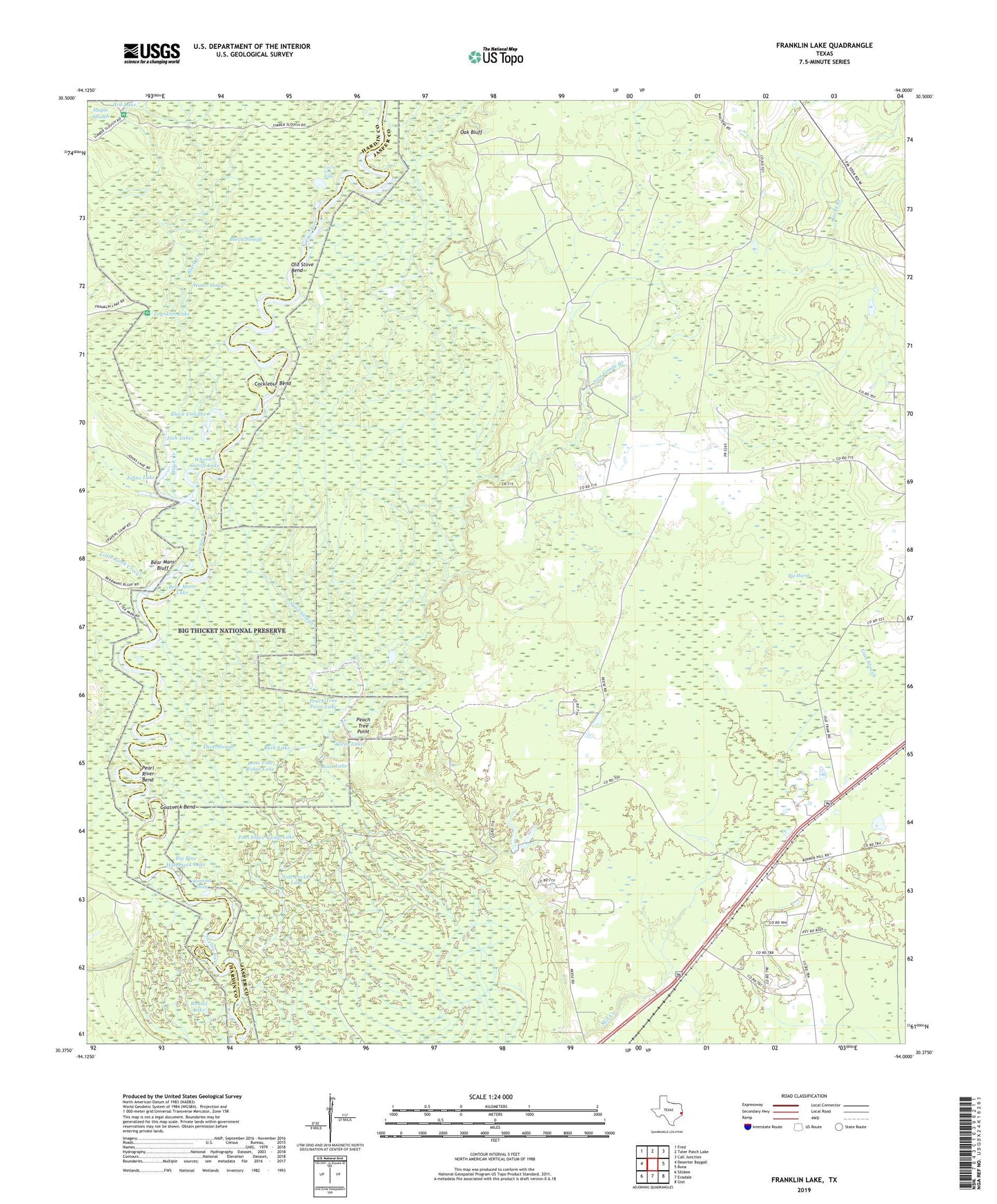
2019 topographic map quadrangle Franklin Lake in the state of Texas. Scale: 1:24000. Based on the newly updated USGS 7.5' US Topo map series, this map is in the following counties: Jasper, Hardin. The map contains contour data, water features, and other items you are used to seeing on USGS maps, but also has updated roads and other features. This is the next generation of topographic maps. Printed on high-quality waterproof paper with UV fade-resistant inks.
Quads adjacent to this one:
West: Deserter Baygall
Northwest: Fred
North: Tater Patch Lake
Northeast: Call Junction
East: Buna
Southeast: Gist
South: Evadale
Southwest: Silsbee
Contains the following named places: Almond Hole, Antioch Church, Ard Lake, Bear Mans Bluff, Bear Mans Lake, Big Marsh, Big Pine Hammock Lake, Black Creek, Black Creek Lake, Boat Lake, Buck Lake, Bucks Branch, Burnt Slough, Clear Lake, Cocklebur Bend, Deep Slough, Fish Lake, Franklin Lake, Goatneck Bend, Gore Landing, Gourd Vine Eddy, Gum Slough, Heart Lake, Johns Lake, Little Black Creek, Lone Pine Ridge Lake, Oak Bluff, Old Stove Bend, Palmer Lake, Peach Tree Point, Peach Tree Point Lake, Pearl River Bend, Pool Stave Camp Lake, Possum Lake, Quinn, Round Lake, Sam Goode Branch, Sand Slough, Shade Lake, Side Pocket Lake, Smith Lake, South Mill Creek Church, Water Slough, Wheeler Cutoff Lake