MyTopo
Call Junction Texas US Topo Map
Couldn't load pickup availability
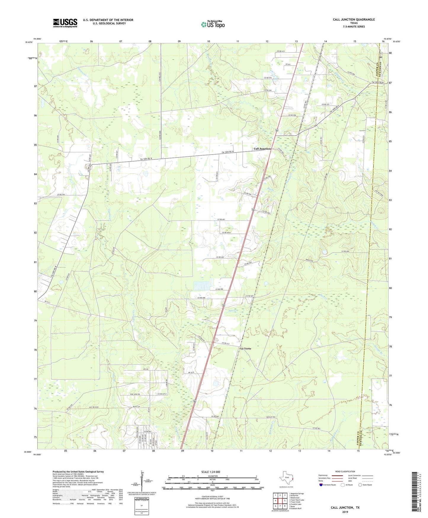
2022 topographic map quadrangle Call Junction in the state of Texas. Scale: 1:24000. Based on the newly updated USGS 7.5' US Topo map series, this map is in the following counties: Jasper, Newton. The map contains contour data, water features, and other items you are used to seeing on USGS maps, but also has updated roads and other features. This is the next generation of topographic maps. Printed on high-quality waterproof paper with UV fade-resistant inks.
Quads adjacent to this one:
West: Tater Patch Lake
Northwest: Magnolia Springs
North: Kirbyville
Northeast: Bleakwood
East: Trout Creek
Southeast: Sudduth Bluff
South: Buna
Southwest: Franklin Lake
This map covers the same area as the classic USGS quad with code o30093e8.
Contains the following named places: Big Branch, Call Junction, Call Post Office, Call School, Deer Creek, Deer Creek Church, Forbes, Garcia Lake, Garcia Lake Dam, Le Verte