MyTopo
Buna Texas US Topo Map
Couldn't load pickup availability
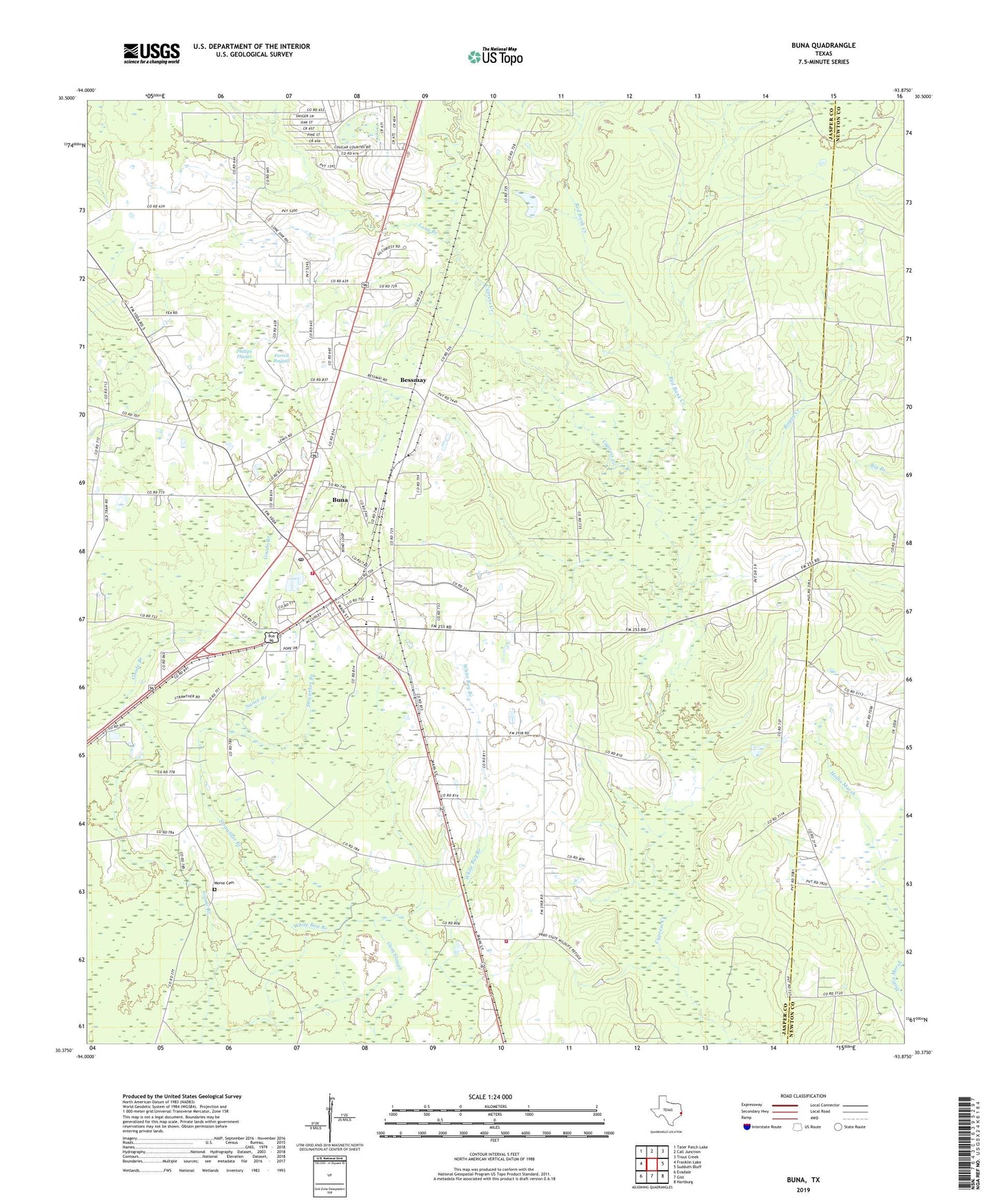
2022 topographic map quadrangle Buna in the state of Texas. Scale: 1:24000. Based on the newly updated USGS 7.5' US Topo map series, this map is in the following counties: Jasper, Newton. The map contains contour data, water features, and other items you are used to seeing on USGS maps, but also has updated roads and other features. This is the next generation of topographic maps. Printed on high-quality waterproof paper with UV fade-resistant inks.
Quads adjacent to this one:
West: Franklin Lake
Northwest: Tater Patch Lake
North: Call Junction
Northeast: Trout Creek
East: Sudduth Bluff
Southeast: Hartburg
South: Gist
Southwest: Evadale
This map covers the same area as the classic USGS quad with code o30093d8.
Contains the following named places: Bessmay, Boggy Creek, Brushy Creek, Buna, Buna Census Designated Place, Buna Division, Buna Fire Department, Buna Post Office, Bunker Hill, Bunker Hill Station, Cougar Country Lake, Cougar Country Lake Dam, Farrell Baygall, Goode Branch, Jasper County Constable's Office Precinct 4, Jasper County Highway Patrol, Long Branch, Morse Cemetery, Nance Branch, Phillips Thicket, Red Bank Creek, Strawther Branch, Texas Forest Service Buna Office, Wright Springs, ZIP Code: 77612