MyTopo
Gafford Chapel Texas US Topo Map
Couldn't load pickup availability
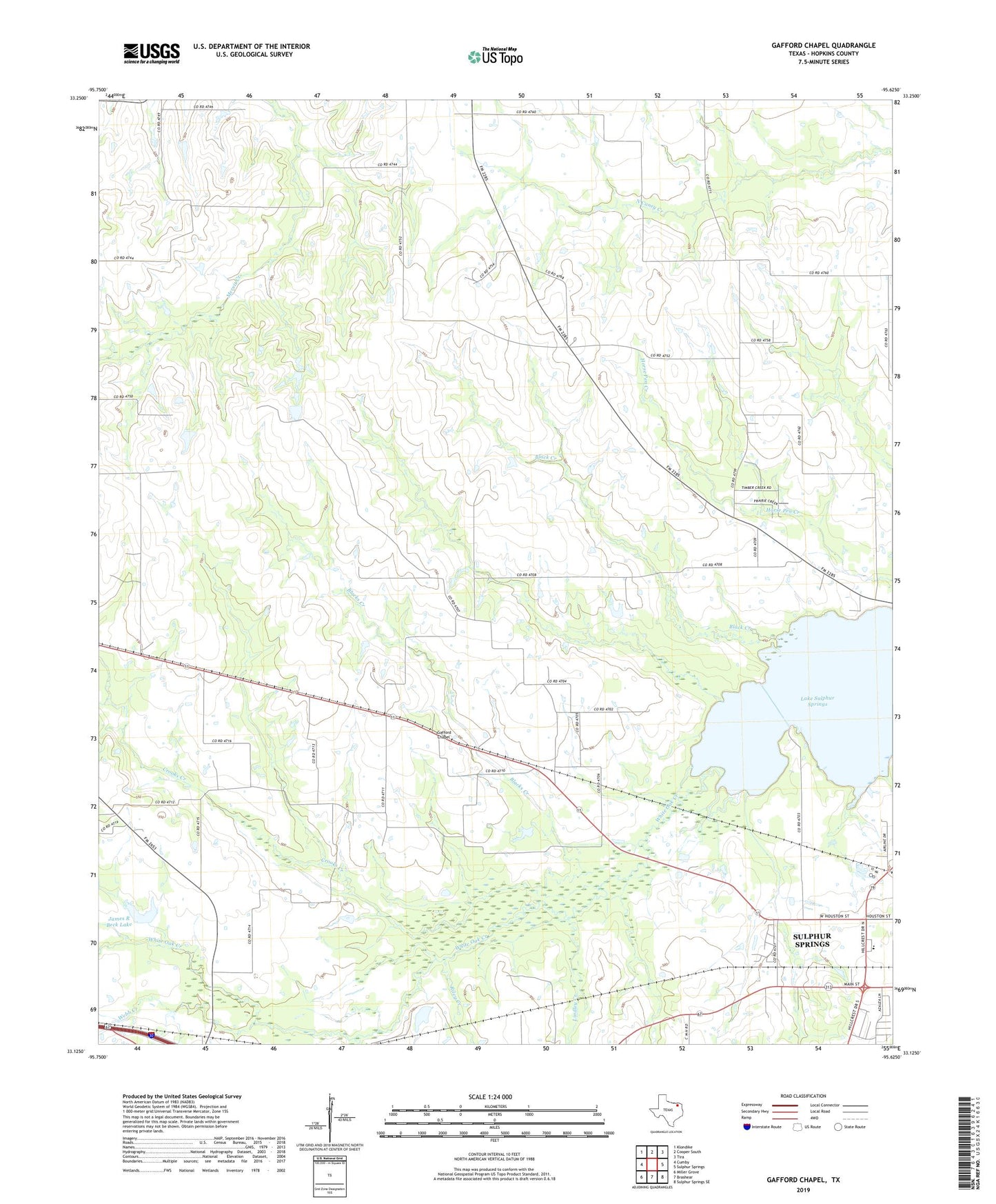
2019 topographic map quadrangle Gafford Chapel in the state of Texas. Scale: 1:24000. Based on the newly updated USGS 7.5' US Topo map series, this map is in the following counties: Hopkins. The map contains contour data, water features, and other items you are used to seeing on USGS maps, but also has updated roads and other features. This is the next generation of topographic maps. Printed on high-quality waterproof paper with UV fade-resistant inks.
Quads adjacent to this one:
West: Cumby
Northwest: Klondike
North: Cooper South
Northeast: Tira
East: Sulphur Springs
Southeast: Sulphur Springs SE
South: Brashear
Southwest: Miller Grove
Contains the following named places: Blacks Creek, Century Lake, Century Lake Dam, Clendening Creek, Crooks Creek, Gafford, Gafford Chapel, Good Neighbor, Good Neighbor Community Center, James R Beck Lake, James R Beck Lake Dam, Lake Sulphur Springs, Lindley Creek, Overland, Pleasant Grove, Pleasant Grove Church, Riley Creek, Saint Luke Church, Sulphur Springs, Sulphur Springs Early Childhood Learning, Webb Creek, White Oak Lake