MyTopo
Galloway Texas US Topo Map
Couldn't load pickup availability
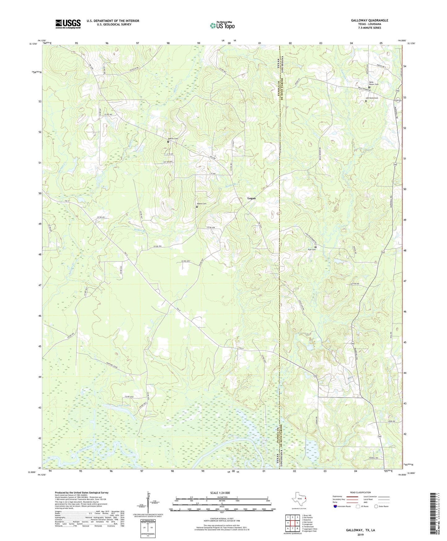
2022 topographic map quadrangle Galloway in the states of Texas, Louisiana. Scale: 1:24000. Based on the newly updated USGS 7.5' US Topo map series, this map is in the following counties: Panola, De Soto. The map contains contour data, water features, and other items you are used to seeing on USGS maps, but also has updated roads and other features. This is the next generation of topographic maps. Printed on high-quality waterproof paper with UV fade-resistant inks.
Quads adjacent to this one:
West: Old Center
Northwest: River Hill
North: Old Panola
Northeast: Keatchie
East: Longstreet
Southeast: Logansport East
South: Logansport West
Southwest: Tenaha East
This map covers the same area as the classic USGS quad with code o32094a1.
Contains the following named places: Adams Cemetery, Belle Bower, Belle Bower Cemetery, Belle Bower Oil and Gas Field, Booker Branch, Clear Lake, Cool Springs Church, Galloway, Galloway Church, Garrison Creek, Holly Grove Church, Horn Cemetery, International Boundary Marker, Logan, Mill Creek, Mim Springs Church, Moorman Creek, Mount Pleasant Church, New Shady Grove Church, New Sulphur Springs Church, Pyle Cemetery, Reeves Cemetery, Teel