MyTopo
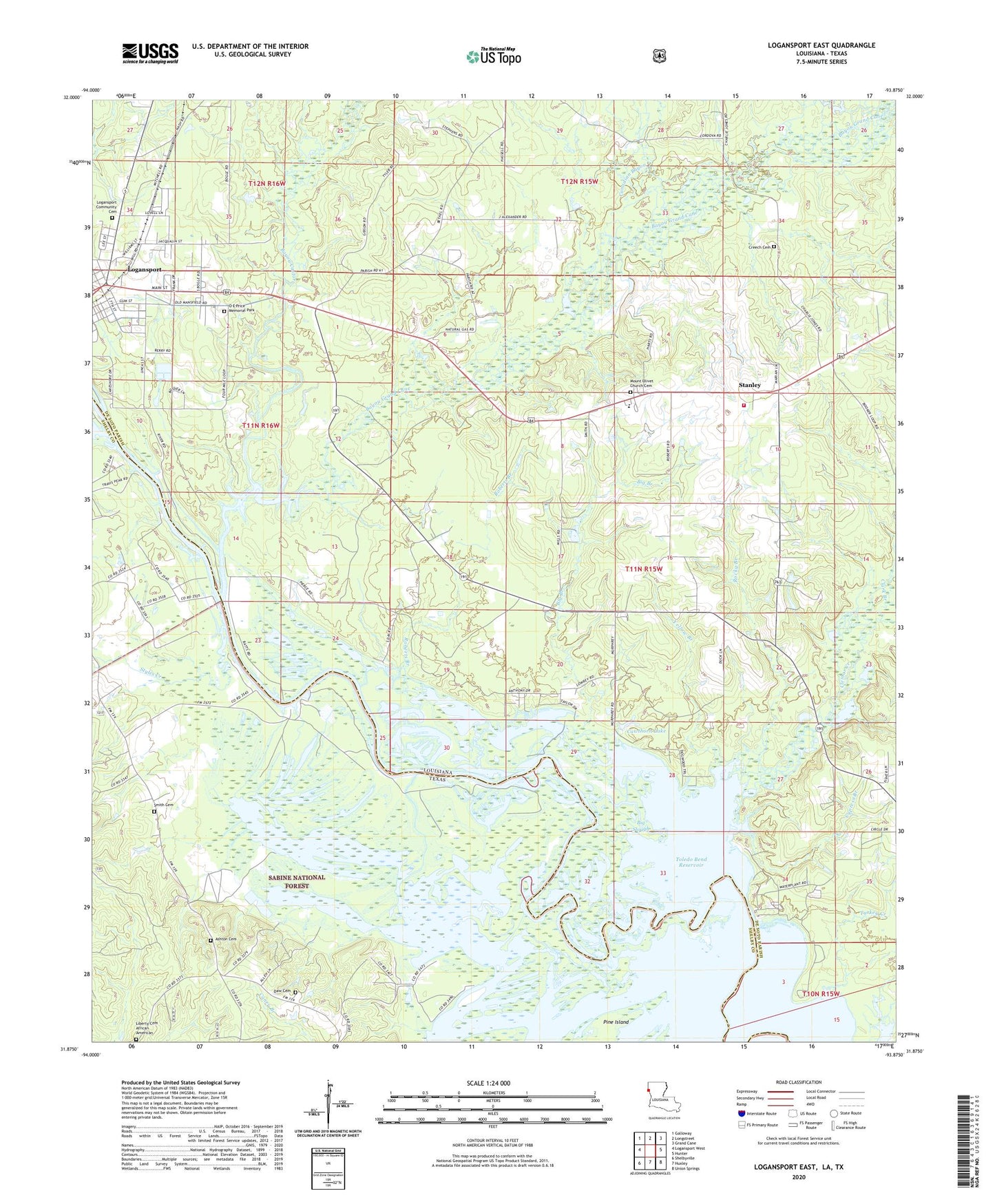
Logansport East Louisiana US Topo Map
Couldn't load pickup availability
Also explore the Logansport East Forest Service Topo of this same quad for updated USFS data
2024 topographic map quadrangle Logansport East in the states of Louisiana, Texas. Scale: 1:24000. Based on the newly updated USGS 7.5' US Topo map series, this map is in the following counties: De Soto, Shelby. The map contains contour data, water features, and other items you are used to seeing on USGS maps, but also has updated roads and other features. This is the next generation of topographic maps. Printed on high-quality waterproof paper with UV fade-resistant inks.
Quads adjacent to this one:
West: Logansport West
Northwest: Galloway
North: Longstreet
Northeast: Grand Cane
East: Hunter
Southeast: Union Springs
South: Huxley
Southwest: Shelbyville
Contains the following named places: Antioch Church, Ashton Cemetery, Ashton Lake, Ashton School, Bayou Castor, Bayou Grand Cane, Big Branch, Big Slough, Canadian Bayou, Cawthorn Lake, Clark Branch, Clemar Creek, Cypress Branch, Cypress Branch Gas Field, De Soto Fire District 5, First Baptist Church, Gum Pond, Horseshoe Lake, Logansport, Logansport Gas Field, Mount Olivet Baptist Church, North Toledo Bend Wildlife Mangement Area, O E Price Memorial Park, Paragon, Petty Creek, Pine Grove Church, Pine Island, Roberts Branch, Rocky Branch, Smith Cemetery, Stanley, Stanley High School, Styles Creek, Town of Logansport, Village of Stanley, Ward Eight, Yellow Branch