MyTopo
Old Center Texas US Topo Map
Couldn't load pickup availability
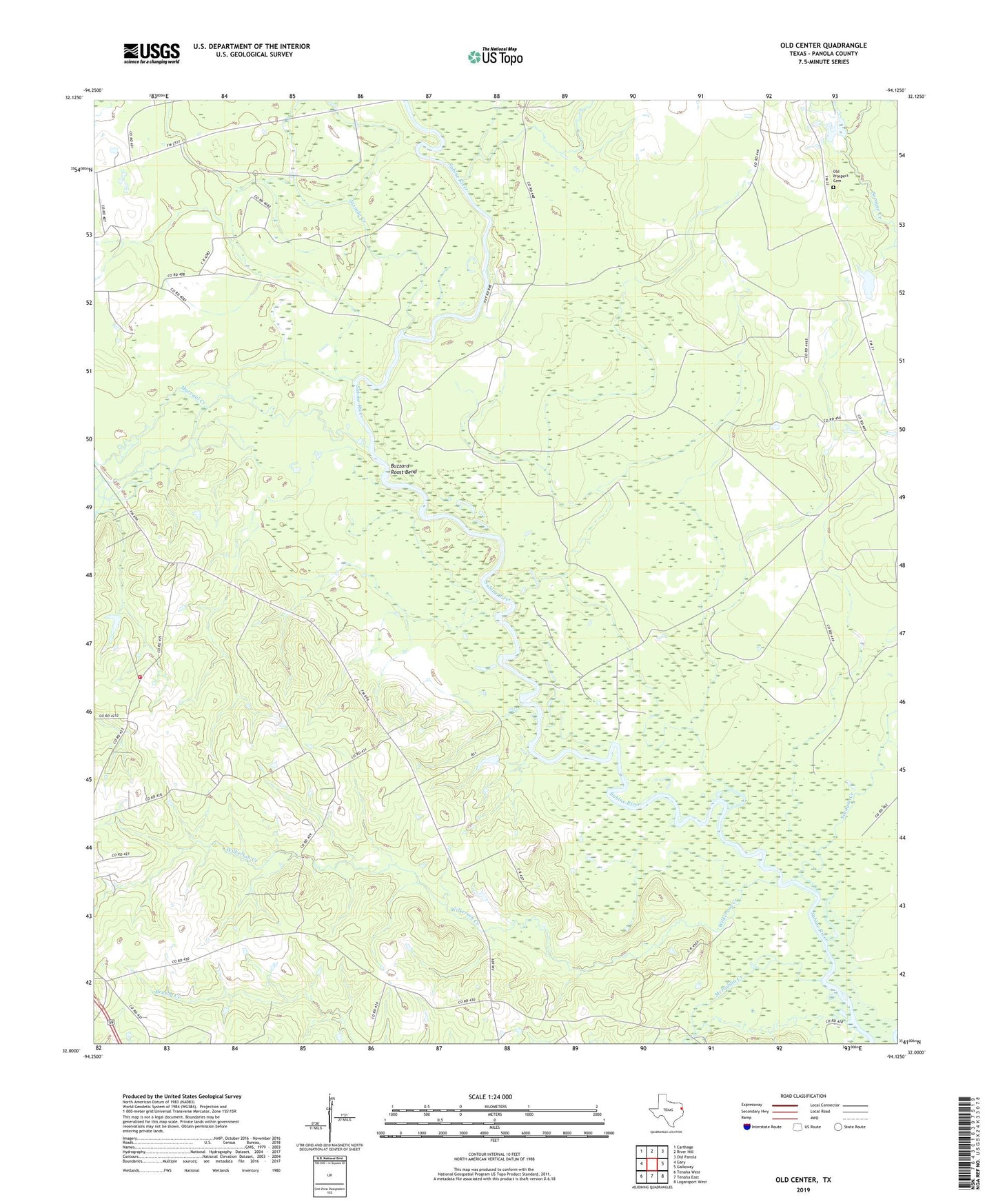
2022 topographic map quadrangle Old Center in the state of Texas. Scale: 1:24000. Based on the newly updated USGS 7.5' US Topo map series, this map is in the following counties: Panola. The map contains contour data, water features, and other items you are used to seeing on USGS maps, but also has updated roads and other features. This is the next generation of topographic maps. Printed on high-quality waterproof paper with UV fade-resistant inks.
Quads adjacent to this one:
West: Gary
Northwest: Carthage
North: River Hill
Northeast: Old Panola
East: Galloway
Southeast: Logansport West
South: Tenaha East
Southwest: Tenaha West
This map covers the same area as the classic USGS quad with code o32094a2.
Contains the following named places: Bounds Lake Dam, Buzzard Roost Bend, Coon Pond, McFaddin Creek, Methodist Church Concord, Murvaul Creek, New Prospect Church, Old Center, Old Center Church, Old Prospect Cemetery, Sixmile Creek, Socagee Creek, Social Point Church, Toledo Bend Reservoir, Wilkerson Creek, Woods, Woods Volunteer Fire Department