MyTopo
Goldsboro Texas US Topo Map
Couldn't load pickup availability
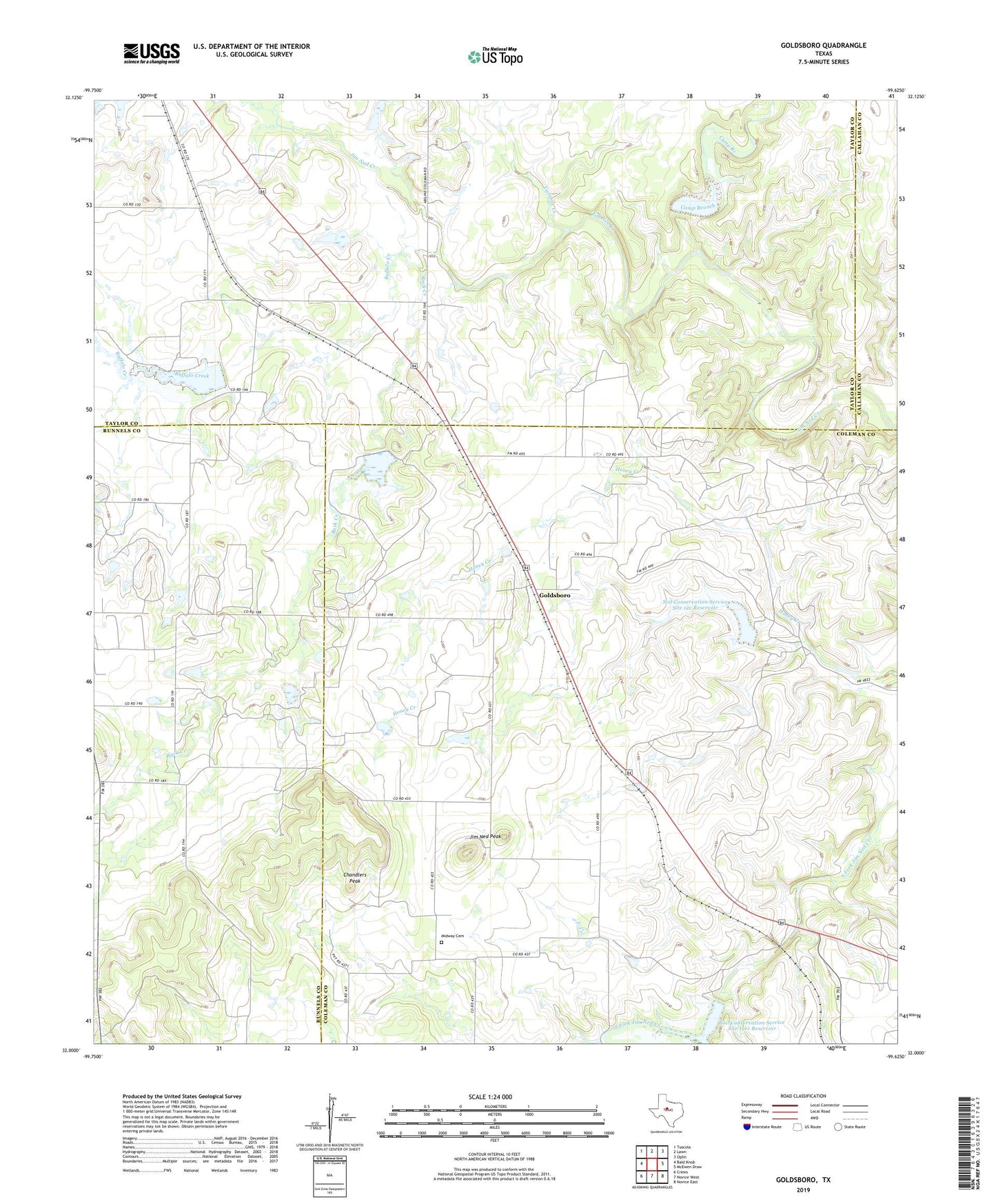
2019 topographic map quadrangle Goldsboro in the state of Texas. Scale: 1:24000. Based on the newly updated USGS 7.5' US Topo map series, this map is in the following counties: Coleman, Taylor, Runnels, Callahan. The map contains contour data, water features, and other items you are used to seeing on USGS maps, but also has updated roads and other features. This is the next generation of topographic maps. Printed on high-quality waterproof paper with UV fade-resistant inks.
Quads adjacent to this one:
West: Bald Knob
Northwest: Tuscola
North: Lawn
Northeast: Oplin
East: McEwen Draw
Southeast: Novice East
South: Novice West
Southwest: Crews
Contains the following named places: Blue Gap, Buck Creek, Buffalo Creek, Camp Branch, Chandlers Peak, Content Cemetery, Goldsboro, Hull-Dobbs Oil Field, Jim Ned Peak, Midway Cemetery, Red Bank Creek, Soil Conservation Service Site 12a Dam, Soil Conservation Service Site 12a Reservoir, Soil Conservation Service Site 12c Dam, Soil Conservation Service Site 12c Reservoir, Soil Conservation Service Site 12e1 Dam, Soil Conservation Service Site 12e1 Reservoir, Soil Conservation Service Site 19 Dam, Soil Conservation Service Site 19 Reservoir, Soil Conservation Service Site 20 Dam, Soil Conservation Service Site 20 Reservoir, Tokeen, Twomile Creek, ZIP Codes: 79519, 79530