MyTopo
Bald Knob Texas US Topo Map
Couldn't load pickup availability
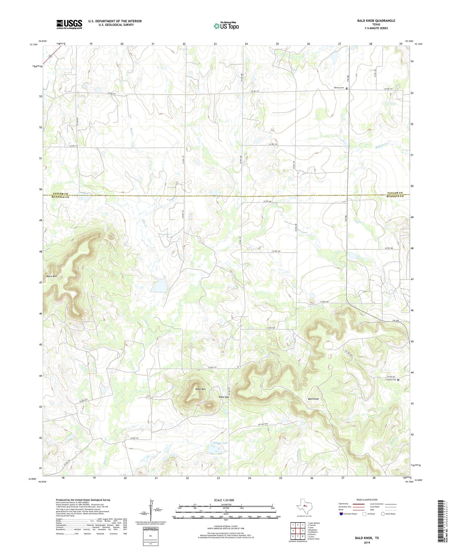
2022 topographic map quadrangle Bald Knob in the state of Texas. Scale: 1:24000. Based on the newly updated USGS 7.5' US Topo map series, this map is in the following counties: Runnels, Taylor. The map contains contour data, water features, and other items you are used to seeing on USGS maps, but also has updated roads and other features. This is the next generation of topographic maps. Printed on high-quality waterproof paper with UV fade-resistant inks.
Quads adjacent to this one:
West: Bradshaw
Northwest: Lake Abilene
North: Tuscola
Northeast: Lawn
East: Goldsboro
Southeast: Novice West
South: Crews
Southwest: Winters
This map covers the same area as the classic USGS quad with code o32099a7.
Contains the following named places: Atwood Oil Field, Bald Knob, Billups Lake, Billups Lake Dam, Counts Cemetery, Dewey Cemetery, Dewey Church, Moro Mountain, Table Gap, Table Mountain