MyTopo
Granbury Texas US Topo Map
Couldn't load pickup availability
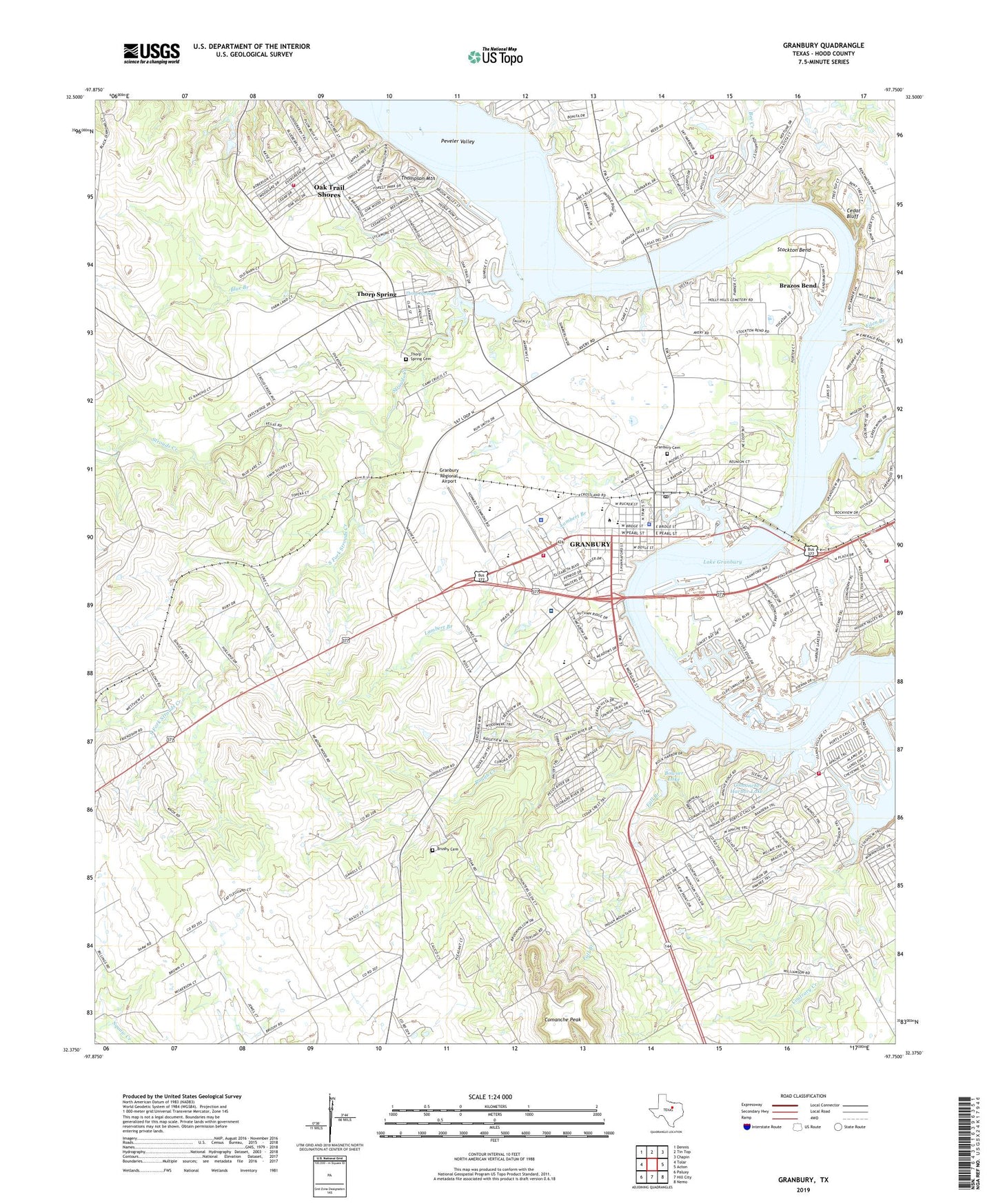
2019 topographic map quadrangle Granbury in the state of Texas. Scale: 1:24000. Based on the newly updated USGS 7.5' US Topo map series, this map is in the following counties: Hood. The map contains contour data, water features, and other items you are used to seeing on USGS maps, but also has updated roads and other features. This is the next generation of topographic maps. Printed on high-quality waterproof paper with UV fade-resistant inks.
Quads adjacent to this one:
West: Tolar
Northwest: Dennis
North: Tin Top
Northeast: Chapin
East: Acton
Southeast: Nemo
South: Hill City
Southwest: Paluxy
Contains the following named places: Bee Creek, Blue Branch, Bowser Lake Dam, Brazos Bend, Brushy, Brushy Cemetery, Camp Crucis, Camp Klebit, Cedar Bluff, Christian Science Society Granbury Church, Church of the Nazarene, City of Brazos Bend, City of Granbury, City of Stockton Bend, Comanche Harbor Lake, Comanche Harbor Lake Dam, Comanche Peak, Eden Branch, Emma Roberson Elementary School, Fall Branch, First Baptist Church, Friendship School, Granburry City Park, Granbury, Granbury Behavior Transition Center, Granbury Cemetery, Granbury City Hall, Granbury High School, Granbury Intermediate School, Granbury Middle School, Granbury Police Department, Granbury Post Office, Granbury Regional Airport, Granbury Volunteer Fire Department Station 1, Granbury Volunteer Fire Department Station 2, Hood County, Hood County Constable's Office Precinct 1, Hood County Constable's Office Precinct 2, Hood County Constable's Office Precinct 4, Hood County Courthouse Historic District, Hood County Jail, Hood County Sheriff's Office, Hood County Volunteer Fire Department Station 70, Indian Harbor Volunteer Fire Department and First Responders, KPAR-AM (Granbury), Lake Arthur, Lake Granbury, Lake Granbury Medical Center, Lakeside Baptist Church, Lambert Branch, Nettie Baccus Elementary School, North Hood County Volunteer Fire Department Station 20, Oak Trail Shores, Oak Trail Shores Census Designated Place, Our Savior Lutheran Church, Paluxy Road Church of Christ, Peveler Valley, Pirate Stadium, Rough Creek, Rucker Creek, Seventh Day Adventist Church, South Fork Strouds Creek, Southside Baptist Church, Stockton Bend, Strouds Creek, Texas Emergency Medical Services, Texas Forest Service Granbury Office, Thompson Mountain, Thorp Spring, Thorp Spring Cemetery, Thorp Springs, Vineyard Baptist Church, Wright-Henderson-Duncan House, ZIP Code: 76048