MyTopo
Acton Texas US Topo Map
Couldn't load pickup availability
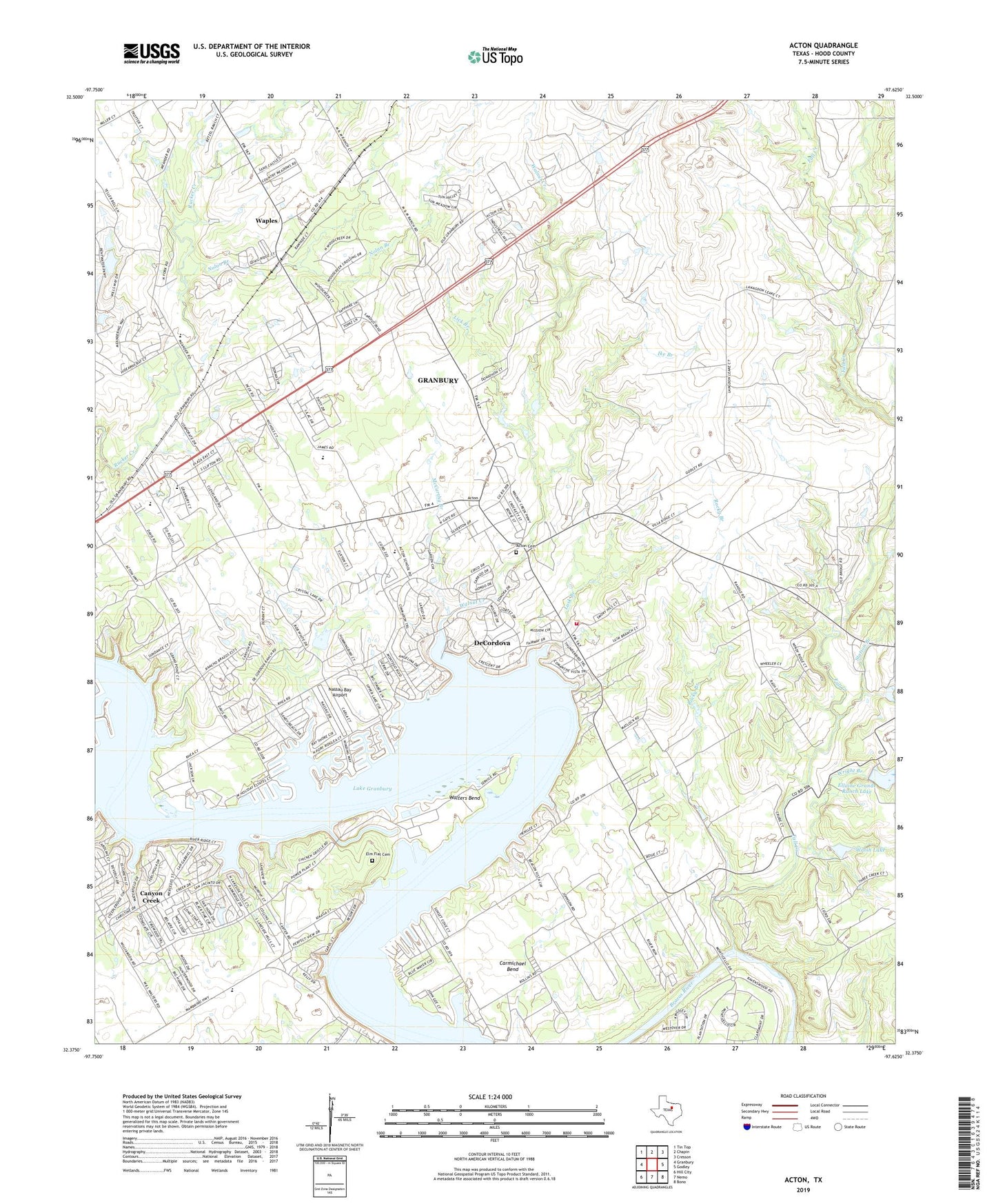
2022 topographic map quadrangle Acton in the state of Texas. Scale: 1:24000. Based on the newly updated USGS 7.5' US Topo map series, this map is in the following counties: Hood. The map contains contour data, water features, and other items you are used to seeing on USGS maps, but also has updated roads and other features. This is the next generation of topographic maps. Printed on high-quality waterproof paper with UV fade-resistant inks.
Quads adjacent to this one:
West: Granbury
Northwest: Tin Top
North: Chapin
Northeast: Cresson
East: Godley
Southeast: Bono
South: Nemo
Southwest: Hill City
This map covers the same area as the classic USGS quad with code o32097d6.
Contains the following named places: Acton, Acton Baptist Church, Acton Cemetery, Acton Elementary School, Acton Post Office, Acton State Park, Camp Leonard, Canyon Creek Census Designated Place, Carmichael Bend, City of DeCordova, Contrary Creek, DeCordova, Decordova Bend Estates / Acton Volunteer Fire Department, El Tesoro, Ellaine Grande Ranch Lake, Ellaine Grande Ranch Lake Dam, Elm Flat Cemetery, Faith Assembly of God Church, Fall Creek, Good Shepherd Episcopal Church, Granbury East Division, Hood County Justice of Peace Precinct 3, Ike Branch, Lick Branch, Lusk Branch, Mambrino School, McCarthy Branch, Nassau Bay Airport, Nolan Branch, Oak Woods Intermediate School, Randle Dam, Randle Lake, Rocky Branch, Saint Frances Cabrini Catholic Church, Station Branch, United Methodist Church Acton, Walnut Creek, Walsh Lake, Walsh Lake Dam, Walters Bend, Waples, Wright Branch, ZIP Code: 76049