MyTopo
Nemo Texas US Topo Map
Couldn't load pickup availability
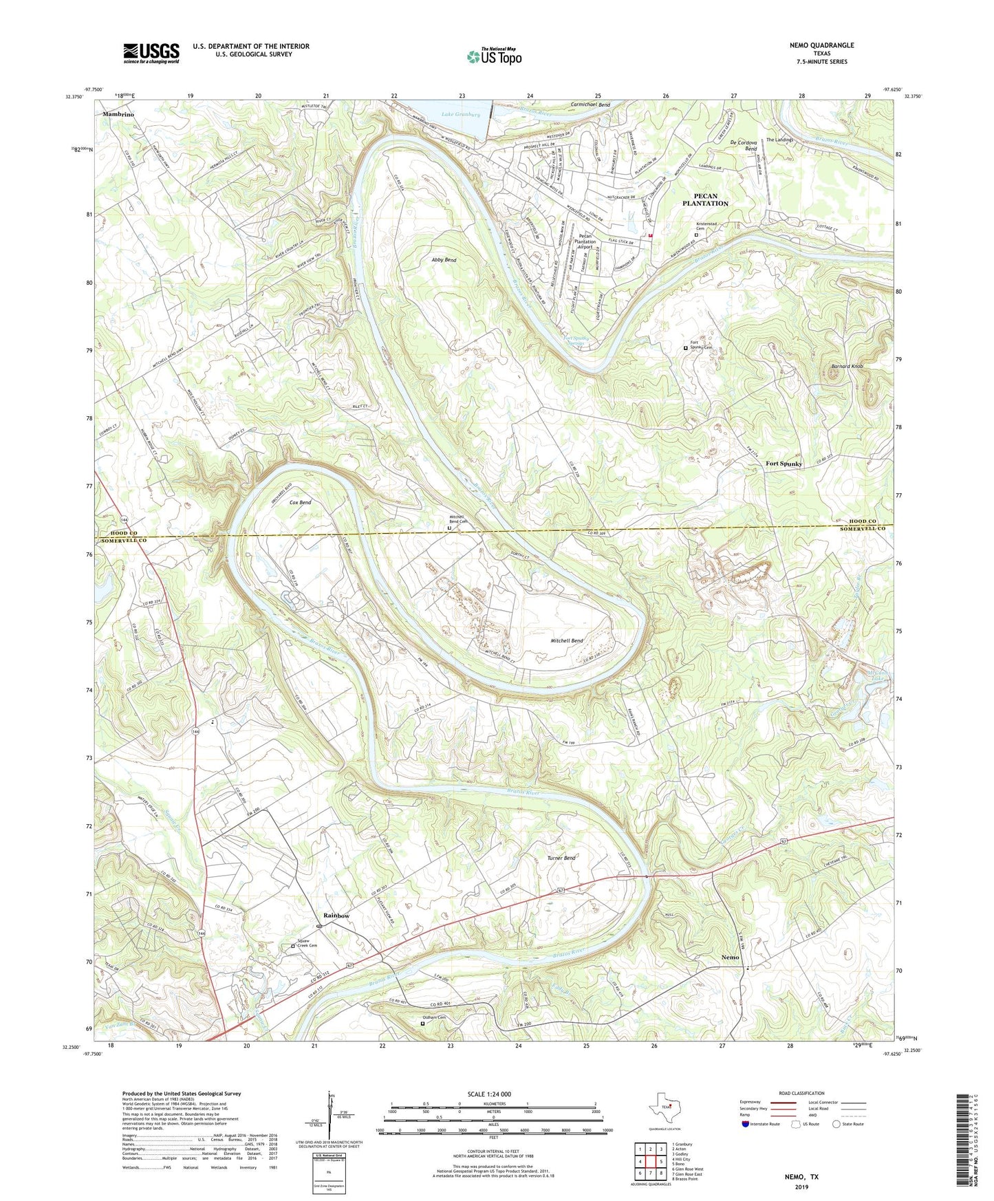
2023 topographic map quadrangle Nemo in the state of Texas. Scale: 1:24000. Based on the newly updated USGS 7.5' US Topo map series, this map is in the following counties: Somervell, Hood. The map contains contour data, water features, and other items you are used to seeing on USGS maps, but also has updated roads and other features. This is the next generation of topographic maps. Printed on high-quality waterproof paper with UV fade-resistant inks.
Quads adjacent to this one:
West: Hill City
Northwest: Granbury
North: Acton
Northeast: Godley
East: Bono
Southeast: Brazos Point
South: Glen Rose East
Southwest: Glen Rose West
This map covers the same area as the classic USGS quad with code o32097c6.
Contains the following named places: Abby Bend, Barnard Knob, Brazos River Baptist Church, Camp Arrowhead, Cedar Grove Church, Cox Bend, De Cordova Bend, De Cordova Bend Dam, Eddy Branch, Fort Spunky, Fort Spunky Cemetery, Fort Spunky Springs, Georges Creek, Happy Hill Farm Academy Baseball Field, Happy Hill Farm Academy Football Field, Happy Hill Farm Academy Gymnasium, Kristenstad Cemetery, KVUE-TV Heliport, Mambrino, McCann Lake Dam, Mitchell Bend, Mitchell Bend Cemetery, Nemo, Oldham Cemetery, Pecan Plantation, Pecan Plantation Airport, Pecan Plantation Census Designated Place, Pecan Plantation Volunteer Fire Department and Emergency Medical Services, Rainbow, Rainbow Camp, Rainbow Post Office, Squaw Creek Cemetery, Taylor Branch, The Landings, Turner Bend, ZIP Codes: 76070, 76077