MyTopo
Dennis Texas US Topo Map
Couldn't load pickup availability
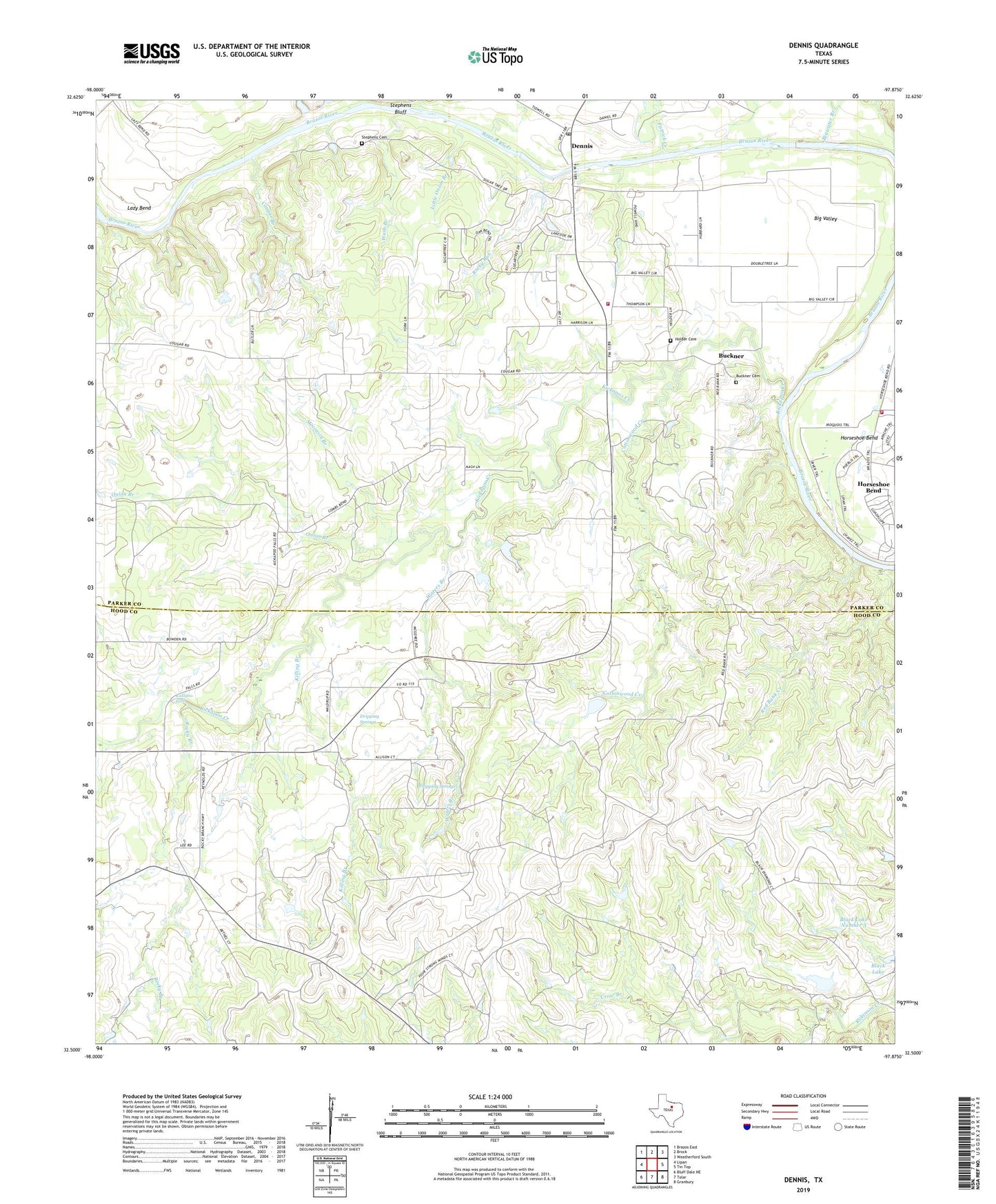
2022 topographic map quadrangle Dennis in the state of Texas. Scale: 1:24000. Based on the newly updated USGS 7.5' US Topo map series, this map is in the following counties: Parker, Hood. The map contains contour data, water features, and other items you are used to seeing on USGS maps, but also has updated roads and other features. This is the next generation of topographic maps. Printed on high-quality waterproof paper with UV fade-resistant inks.
Quads adjacent to this one:
West: Lipan
Northwest: Brazos East
North: Brock
Northeast: Weatherford South
East: Tin Top
Southeast: Granbury
South: Tolar
Southwest: Bluff Dale NE
This map covers the same area as the classic USGS quad with code o32097e8.
Contains the following named places: Aldenhoven Lake Dam, Allison, Big Valley, Bigwater Branch, Black Lake Number 2, Black Lake Number 2 Dam, Black Lake Number 3, Black Lake Number 3 Dam, Black Lake Number 4, Black Lake Number 4 Dam, Black Ranch, Brock - Dennis Volunteer Fire Department Station 2, Buckner, Buckner Cemetery, Cottonwood Creek, Cougar Branch, Cougar Cemetery, Crow Branch, Dennis, Dennis Census Designated Place, Dennis Post Office, Dripping Springs, First Baptist Church of Horseshoe Bend, Holder Cemetery, Horseshoe Bend, Horseshoe Bend Census Designated Place, Horseshoe Bend Volunteer Fire Department Station Number 3, Kickapoo Creek, Kickapoo Falls, Killing Branch, Lazy Bend, Little Onion Branch, Maxwell Crossing, Moccasin Branch, Morton Cemetery, Onion Branch, Patrick Creek, Powell Crossing, Red Bank Creek, Rocky Branch, Rocky Run, Stephens Cemetery, Stephens Crossing, Wash Branch, Waters Branch